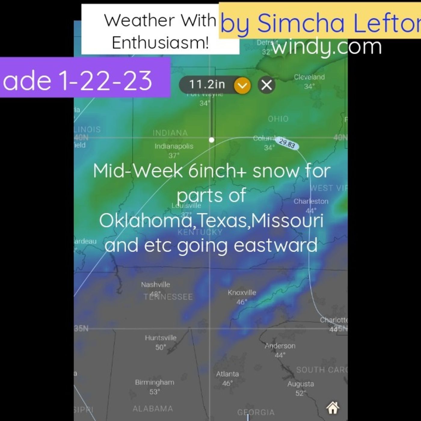
Discover Weather With Enthusiasm !

Weather With Enthusiasm !
Author: Simcha Lefton
Subscribed: 5Played: 41Subscribe
Share
© Copyright Simcha Lefton
Description
This podcast is made by weather enthusiast Simcha Lefton..
This podcast speaks about storms, heateaves and other weather extremes impacting the Midwest and sometimes elsewhere. The delivery is passionate and professional.
A lot of hard work and about many hours of time and money is invested in each episode. Preparation is done reading through forecast discussions from the 5 national weather service offices that cover the marine synopsis for the great lakes. Additional offices used include several more cities depending on where the storm in question will be developing. The computer models as advertised on Windy.com are used in the preparation as well with an emphasis on the European model.
Become a supporter of this podcast: https://www.spreaker.com/podcast/weather-with-enthusiasm--4911017/support.
635 Episodes
Reverse
Become a supporter of this podcast: https://www.spreaker.com/podcast/weather-with-enthusiasm--4911017/support.
10 Day Forecast For United StatesThe following description was made with A.I. and has not been edited. Brace yourselves as we embark on an exhilarating journey through a meteorological spectacle, tracking a bone-chilling cold front sweeping across the country. Ever wondered how it feels when temperatures plunge from a balmy 80s to a frosty 40s within a day? Tune in as we decode the dramatic shift in the weather scene of Rio Grande Village, Texas, and the return of the zonal flow across the nation. Don't forget to pack your winter woolens as we head to Minneapolis and Chicago, with temperatures bobbing below 40 degrees. Snow lovers, get ready, because we've got the forecast on snowfall accumulations for the upper Midwest. And for those in Los Angeles, prepare for the arrival of the Santa Ana winds.As we steer the conversation global, prepare to be spellbound by the extremes mother nature has to offer. Imagine waking up to feet of snow in Japan or bracing yourselves against temperatures soaring over 104 degrees. Listen close as we dive into the impact of these extreme weather conditions and arm you with tips to stay safe during these wild shifts. Let's also take a moment to marvel at the spectacle of thunder and lightning, and perhaps find a rainbow in the sky. Hop on for this rollercoaster weather ride and embrace your inner weather enthusiast. The forecast has never been more fascinating!Episode link: https://play.headliner.app/epi...(video made with https://www.headliner.app)Become a supporter of this podcast: https://www.spreaker.com/podcast/weather-with-enthusiasm--4911017/support.
Become a supporter of this podcast: https://www.spreaker.com/podcast/weather-with-enthusiasm--4911017/support.
Become a supporter of this podcast: https://www.spreaker.com/podcast/weather-with-enthusiasm--4911017/support.
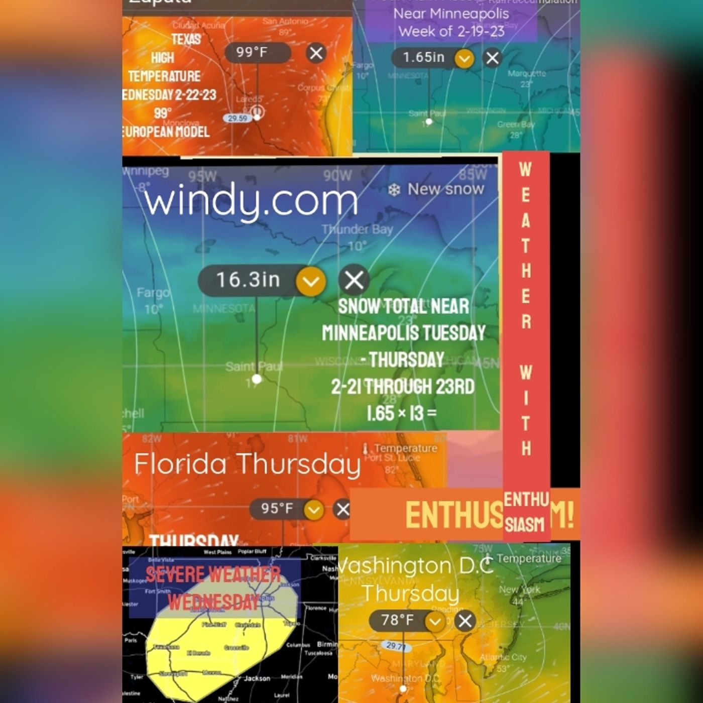
Late winter Heat Wave severe weather along with a 2-ft snow storm and ice storm week of February 19th 2023. 99° Heat for Zapata Texas --- Support this podcast: https://anchor.fm/weather-with-enthusiasm/supportBecome a supporter of this podcast: https://www.spreaker.com/podcast/weather-with-enthusiasm--4911017/support.
--- Support this podcast: https://anchor.fm/weather-with-enthusiasm/supportBecome a supporter of this podcast: https://www.spreaker.com/podcast/weather-with-enthusiasm--4911017/support.
https://docs.google.com/docume... Unknown 0:00 A historical Arctic outbreak over the Gulf Coast from two years ago. 2021 there is a one minute introduction and then the podcast. The following podcast was given February 14, the year was 2021. It was right before the 18th and snowstorm that hit West Rogers Park 10 inches at O'Hare Airport. More importantly, this is right was given during the Arctic outbreak over one of the coldest Arctic outbreak over Texas winter storm across the Gulf Coast. Every county in Texas was under a winter storm warning. This podcast is hard to find. It's a rarity. It happened to have become popular on YouTube. So I've placed it onto here. I hope everybody enjoys. There's an enormous amount of other very interesting facts that take place throughout this podcast, including fascinating stuff going on in Africa in Mexico and throughout the rest of the world. Unknown 1:13 strong storm system of 29.5 inches located over in the southern Missouri area. Moving across southern Illinois is producing a major winter storm across parts of Texas and even Arkansas, Louisiana. These are states going all the way down to the Gulf Coast. Some of these areas have not seen winter storm warnings for years Brownsville Texas is under a winter storm warning Believe it or not. That's really amazing. It's the first time in 10 years. Some of these places in Texas are seeing the coldest temperatures since 1989. And some of them are seeing the coldest temperatures in over 100 years. Oklahoma temperatures dropping under 10 below. Very, very cold air arctic air making it all the way down to Houston, Texas, the temperatures dropped down to 12 degrees. By Tuesday morning and Houston, Texas that's super cold temperatures going down into the 20s in New Orleans. But the main story for tonight is the snow storm and the ice storm freezing rain, sleet and snow throughout probably the entire state of Louisiana. And throughout Texas freezing precipitation is even expected all the way down into Brownsville, Texas. Some of those places which were in the mid 90s, just a week ago or two weeks ago, are now going to be getting freezing precipitation. It's quite an amazing today's high temperature. This is totally remarkable. High temperature today was 94 degrees in three different cities in Georgia. Now the National Weather Service says the high was 90 in a place in Florida. But there are actually three different cities in Georgia that hit 94 degrees. These are cities which were which are ahead of the storm system, and they are under south winds. Another thing to keep in mind is that we're already in mid February. That means we're about seven weeks off of the Winter Solstice. So the ultraviolet index in the sun is really heating up right now. In fact here in Chicago in January, the highest they can ever get to is a one. But now it's already at a three and a three you could already get suntan and stuff like that. So by the end of this week, when the warmer temperatures come in which by the way, we are getting warmer temperatures here in Chicago and we're even going to get some sunshine. The forecast ultraviolet index here in Chicago is actually going to be a three and many people could get a suntan when the ultraviolet index is at that level. In any case, the rest of the country we have winter storm warnings all over the place. Really all over the place. storm track has gone a little bit further Northwest than originally thought yesterday. The storm is also stronger than we then what was originally thought yesterday. Therefore Chicago has been placed in a winter storm warning eight to 12 inches of snow. Luckily Alma, I believe everyone agrees to this. Eight to 12 inches of snow higher amounts are also possible. And here's the deal. The Chicago area is about to get snow with with a snow to water ratio of 20 to one or as the Northern Indiana National Weather Service puts it anywhere between 18 to 22. To one we don't get snow like that very often. I think we haven't getting snow like that over the past week. It's super powdery stuff. About two tenths to four tenths of snow of water equivalent is what's expected in places like in northern Indiana, that would bring snow totals up between four and eight inches here in Chicago. They are expecting a heavy Lake ABand Lake pant. What is it? A lakes heavy Band of Lake snow to set up right across the city of Chicago. It's going to start off in Northwest Indiana tonight. But it's gradually going to move west. Sometimes those things do that. They move west and it's actually going to set up right over the Chicago area. And if that does, those things are not always so predictable. But, or at least their predictions are not always so accurate. But you have to realize we have extremely cold air going over the waters of Lake Michigan. So whatever does happen, the snow is going to be heavy, really heavy. If there should be a band of Lake effect snow that sets up over our area, you could expect have the lake effect snow, probably tomorrow morning six or 7am. There also might be another band of heavy snow moving in tomorrow evening. It could be that some of the precipitation may stop during the day tomorrow, total storm accumulations again between now and Tuesday morning, eight to 12 inches, but some areas will be getting higher amounts. And the reason why the amounts are so high is two reasons. It's number one, the snow to water ratio is very, very high. So this stuff piles up real quick. Some areas like beginning snowfall rates of one to two inches in our number two, it's the lake effect. The actual storm is for the most part, it stinks south of us, the higher the highest amounts of 812 inches are basically in central Illinois. And they kind of go down and then it goes back up towards 12 inches here in the Chicago area. We're gonna see lots of wind. By the way, there's a blizzard warning, which is in effect for Texas right now, areas in Texas are under a blizzard warning. It's the only place in the country, which has a blizzard warning right now, with the most dangerous warnings right now in effect, they're probably the air quality alert, which continues to be in effect for Fairbanks, Alaska. And the avalanche warning, which is in effect for several areas in Utah. At least it's that National Weather Service. That's the Salt Lake City National Weather Service that is reporting these avalanche warnings, they don't make the avalanche warnings. It's some other organization that does that. But they are reporting it. Now here, I would say the two most remarkable things of the weather today and yesterday. Number one, I mentioned 94 degrees in three different cities in Georgia. It's mid 90s. And we're holding in the month of mid February. And you know what? If it's going to be in the mid 90s? They need a round of applause Unknown 7:22 and a chair. Okay, so it's mid 90s. In those three cities, Texas, I don't know what to do about that. The whole state is under a winter storm warning does is that a round of applause because they're scared. I'm sure they're scared. But a lot of people are probably really happy because they don't really get to see snow so much. But this year, they have been getting a lot of snow over there. So we're not going to do a round of applause for them. But in any case, out on the West Coast, we have serious heat that's going to be starting to build throughout this week. By the end of the week, temperatures are going into the low 90s in Palm Springs, California. Now, there's also by the way, another storm system. This one's actually stronger and deeper, which will be developing in the middle part of this week. I don't know if it's going to be hitting Chicago or not. It probably won't. Or if it does probably just the northern edge. That's what I think. But in any case, that storm system is going to be intensifying to a barometric pressure of 29.3. The chances are the majority of the energy of that storm is going to be taking shape on the east coast. It's going to ship it's going to shift over to the east coast from the Louisiana area. I think what is important to do, I don't know if it's important or not, but we have let me get it right here. I have there's some cities here, which there's some remarkable stuff. Okay. The cities Whitesburg, Georgia, the high temperature today was 94 degrees. Tonight it's going down to 43. The high tomorrow 49 degrees. So today's high was 94. Tomorrow's 49. Tomorrow night going down to 30 degrees. And then Tuesday night going down to 25 degrees. Temperatures back into the mid 60s. By a week by next Tuesday a week. Next week. Okay, that's Whitesburg, Georgia, the 94 degrees is what's most remarkable. I would be very curious to see if they had humidity over there because Georgia usually gets humidity but I wonder like how can you hit 94 With humidity this time of the year? Well, you never know. Okay, now. We're going to quickly mention Wolfsburg, Germany, nothing that amazing but in Wolfsburg, Germany. They're also getting snow. I don't know how much but the snow it looks like we'll be changing over to rain. The low this morning was 11 degrees. Temperatures are going to become much warmer as the week goes on temperatures rising into the mid 50s. And that's nothing really that remarkable some of the hotspots in India is starting to get hot again in in ahamed a bad med the bad India, temperatures going up to 96 degrees by next week. Compare that to Aurora Illinois, where temperaBecome a supporter of this podcast: https://www.spreaker.com/podcast/weather-with-enthusiasm--4911017/support.
Following the winter storm watch in effect from the Omaha Nebraska National Weather Service several additional feet of snow is expected by Monday morning. People were reporting frost quakes these are earthquake like tremors we have a powerhouse typhoon which has developed off in the Pacific ocean deep dig Shaka wrote to many of you. We have parts of the world that are so hot right now temperatures are expected to go into the low 130. record temperatures during heat bursts have reached well above 104 degrees. It's a rare atmospheric phenomenon. We're going from one extreme to the next extreme. feet of snow or falling in Japan is Google weather with enthusiasm and they're all kind of come upfor lightning in the rainbow in the sky, mountains and four oceans river running backThis transcript was generated by https://otter.aiBecome a supporter of this podcast: https://www.spreaker.com/podcast/weather-with-enthusiasm--4911017/support.
Severe weather outbreak Wednesday and Thursday (includes Ohio), record warmth, another winter storm. Podcast made Tuesday February 14th 2023. --- Support this podcast: https://anchor.fm/weather-with-enthusiasm/supportBecome a supporter of this podcast: https://www.spreaker.com/podcast/weather-with-enthusiasm--4911017/support.
National Weather Service in Chicago has issued a winter storm watch for Thursday February 16th --- Support this podcast: https://anchor.fm/weather-with-enthusiasm/supportBecome a supporter of this podcast: https://www.spreaker.com/podcast/weather-with-enthusiasm--4911017/support.
Two Winter storms of 6+ inch snows to track across Midwest This Week. In addition a multi-day Severe Weather outbreak in the South is expected along with unseasonable warmth for the majority of the Midwest.. 70s in Missouri and record Warmth even in Wisconsin. This is only a 1 minute extract from the full 20 minute February 12th podcast. --- Support this podcast: https://anchor.fm/weather-with-enthusiasm/supportBecome a supporter of this podcast: https://www.spreaker.com/podcast/weather-with-enthusiasm--4911017/support.
Coastal Eastern cities may see snow... finally as we wait for the full domino effect of an SSW (forecast to happen about 2/15/23) to play out for the final Month of Winter. An SSW can unleash Arctic air in as early as 1 week, but others say 2. Based on observations of recent years it can take 3 or even 4 weeks especially for Norh America. --- Support this podcast: https://anchor.fm/weather-with-enthusiasm/supportBecome a supporter of this podcast: https://www.spreaker.com/podcast/weather-with-enthusiasm--4911017/support.
Made 2/12/23: Major winter storm with a severe weather outbreak tracks across the Midwest for the 5th consecutive week. A severe weather outbreak is expected on the Southeast side. On seasonably warm weather is expected prior to the snow in some locations. A sudden stratosphere warming of 60° is expected according to the Washington Post this week. This may unleash major Arctic air within one or two weeks which could lead to an end to the snow drought for the East Coast cities next month. --- Support this podcast: https://anchor.fm/weather-with-enthusiasm/supportBecome a supporter of this podcast: https://www.spreaker.com/podcast/weather-with-enthusiasm--4911017/support.
2-9-23: Active pattern: European model forecasts big Midwest storm late next week around 2-16-23. Chicago might end up on the snow side. Significant snow this weekend in the southeast. An additional storm as well next week for Midwest. --- Support this podcast: https://anchor.fm/weather-with-enthusiasm/supportBecome a supporter of this podcast: https://www.spreaker.com/podcast/weather-with-enthusiasm--4911017/support.
Summary of Midwest Hazards for today and tomorrow 2-8-23 --- Support this podcast: https://anchor.fm/weather-with-enthusiasm/supportBecome a supporter of this podcast: https://www.spreaker.com/podcast/weather-with-enthusiasm--4911017/support.
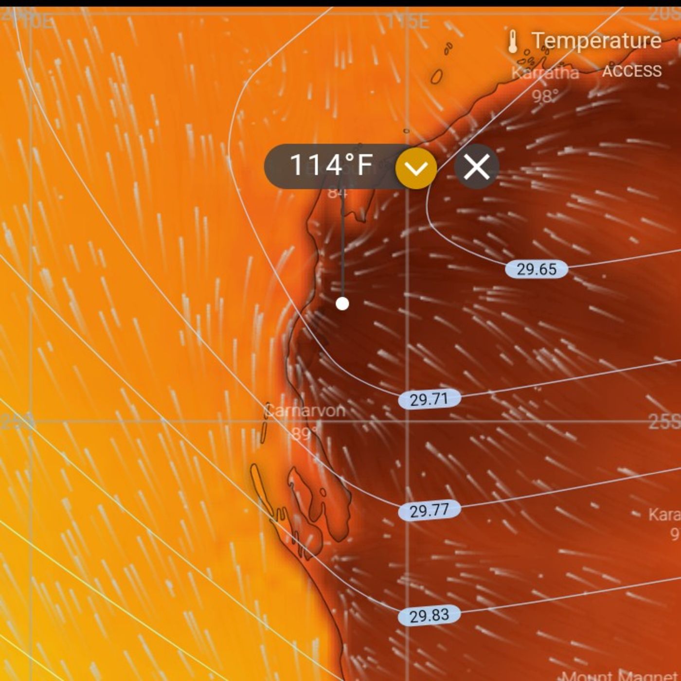
July 6 into July 7 in Oklahoma in the year 2016.One of the most inspirational events in weather that can possibly happen is something which is known as a heat burst. People are not going to believe this. Those of you that have never heard of the heat burst before will have a hard time fathoming what this is even those that have heard of it and try to understand it. This is very difficult going back to July 7 2016. At Hubbard municipal Municipal Airport H O dar TMUN ici pa l Airport. This was in Oklahoma now elevation of 1562 feet latitude 34.9 degrees north, the city called Holbert, Oklahoma H OB AR T Oklahoma. The temperature initially was 80.6 degrees. That took place July sixth at 11 o'clock pm the temperature was in Hubbard Oklahoma was 80.6 degrees, what we would call 81 degrees Fahrenheit 27 degrees Celsius. By 1215. In the morning, the temperature was 106 105.7 degrees Fahrenheit 40.9 degrees Celsius. That occurred on July 7 2016. This is a phenomenal heat burst. Nobody really understands how it works. It's a rare atmospheric phenomena which is characterized by a sudden localized increase in air temperature near the Earth's surface. They usually occur during the night and are associated with thunderstorms that are falling apart. They also usually have extremely dry air, and sometimes you can get very strong even damaging winds associated with the event. No one really fully understands it. But it's thought to occur when the rain evaporates into an area of cold dry air high in the atmosphere. This makes the air denser than its surroundings. This parcel of air descends rapidly warming due to compression and overshoots. Its equilibrium level and it reaches the surface similar to a downburst. Recorded temperatures during heat bursts have reached well above 104 degrees Fahrenheit 40 degrees Celsius, sometimes rising by 10 degrees Celsius, or 18 degrees Fahrenheit or more within only a few minutes. These things occur at night. The one Hubbard Oklahoma seems to be one of the strongest ones that has ever happened. There is one that's stronger in South Dakota, a city in South Dakota August 8 August 2000 August 3 2008. Temperature was 70 degrees. It rose 31 degrees to 101 degrees. This is something that we're going to have to look more into it's unbelievable stuff Chicago has had a couple of them as well, especially in the year 2017.You have been listening to the podcast weather with enthusiasm This trailer was updated at the very end of January 2023. We have two things going on. We have evaporative cooling, and we also have dynamic cooling, and the two are coming together to produce a major snow storm in the Deep South. The only time you could blame cold air on climate change is when it's a result of the stratosphere warming, which is what causes all the arctic air to come down. So the way to get a six in snow storm here in the Midwest and in the Southern Plains has always been you need three ingredients. It's hard to believe the numbers that are being forecastedseveral additional feet of snow is expected by Monday morning.We have a special guest on our show What is your name this one 7.1 barometric pressure feet of snow are falling in Japan that's a time of celebration is Google of weather with enthusiasm and they're all going to come upThis transcript was generated by https://otter.aiBecome a supporter of this podcast: https://www.spreaker.com/podcast/weather-with-enthusiasm--4911017/support.
Motzei Shabbos Saturday night February 4. 2023 5783You're listening to weather with enthusiasmAn Arctic airmass of unbelievable cold over spread the East Coast northeast, the New England area earlier today last night. This is going to be followed by much warmer temperatures as we head into tomorrow and Monday. This airmass broke records all over the place in the New England area. Windchill dropped to 108 degrees below zero that's 108 below zero in Mount Washington, New Hampshire. We have that is the coldest ever reported there. Temperatures across the Northeast reached lows that have not been seen in decades. The National Weather Service office in Boston described the cold as a historic Arctic outbreak for the modern era. And they said this is about as cold as it will ever get. On Friday, the National Weather Service said This is once in a generation event. But here's the thing that's truly unbelievable. This is something that I've never heard of before that type first of all, the type of coal that happened in the Northeast in the New England area is the type of an annual cold that or may perhaps not annual, but is the type of coal that's reported in the wintertime in the places like North Dakota and Minnesota, places like that we've seen cold like this earlier this year, in places Minnesota and North Dakota the very end of December. But this is something that does not normally occur in New England. It is not nearly as cold in New England, the weather extremes are not nearly as cold temperatures of 10 degrees below zero was reported in Boston earlier today. That's a record eight degrees below zero or reported on Friday in Boston. That's also a record. And that's extremely cold for that city. You know, here in the Midwest, we get temperatures that cold almost annually, the Chicago Illinois area on average sees the coldest temperature of the year near seven below zero. And it's not something that happens in Boston. So this is something very intense for that area. It's really in some cases, we had temperatures that went into the 30s below zero in it places in New York. 30 is below zero. That's certainly comparable to stuff that would happen in the Midwest. But here's something that never heard up before. Frost quakes were reported, says the Washington Post in Maine, the temperatures were so extreme in Maine, people were reporting frost quakes. These are earthquake like tremors which are caused by rapidly plummeting temperatures. It causes the water trapped in cracks in the ground to expand. There were reports of trees exploding. Trees were exploding, which was the result of quickly expanding water stored in SAP reports the Washington Post, some in the northern New England area, we're hearing sounds like gunshots throughout the night. In upstate New York, the actual temperature dropped to 38 degrees below zero. There were also winter waterspouts reported on Lake champion and over the open Atlantic. Canada looks like a tornado resembles a tornado. It's more of a devilish vortex of stream frigid air blowing over the comparatively mild waters which also caused the rare type of fog known as Arctic sea smoke to form that stuff we've seen here in Chicago on Lake Michigan. This Arctic snap is the result of two low pressure systems which were to the north. There was a low pressure system pushing east through Ontario. There was an Arctic high pressure over the northern winds. This caused an area of polar air from near the Hudson Bay to move south east. At the higher altitudes, we have a piece of the polar vortex, which is a pool of frigid air. That one dived from near Hudson Bay, Canada directly over main. Here's something that's also amazing. It's the stratosphere, which is usually about 20,000 feet above the surface. About four to 12 miles up, dropped and actually dropped to less than a mile the top of Mount Washington was in a completely different invite atmosphere. It was within the stratosphere were one would have thought there would have been enormous amounts of ozone if that was the case, but that was not reported. The top of Mount Washington 6288 feet, temperatures are headed into the 40s and 50s. over much of the New England area, actually Boston probably low 50s for Sunday and Monday. In some cases, this is a rise of 70 degrees for places in New England within a 24 hour period.You have been listening to the podcast weather with enthusiasm this trailer was updated at the very end of January 2023. We have two things going on. We have evaporative cooling, and we also have dynamic cooling, and the two are coming together to produce a major snow storm in the Deep South. The only time you could blame cold air on climate change is when it's a result of the stratosphere warming, which is what causes all the arctic air to come down. So the way to get a six in snow storm here in the Midwest and in the Southern Plains has always been you need three ingredients. It's hard to believe the numbers that are being forecastedseveral additional feet of snow is expected by Monday morning.Can we have a special guest on our show? What is your name? Yisroel Zev, Good Shabbos. Feet of snow are falling in Japan. Oh my gosh."Google" "weather with enthusiasm" and they're all going to come upThis transcript was generated by https://otter.aiBecome a supporter of this podcast: https://www.spreaker.com/podcast/weather-with-enthusiasm--4911017/support.
2-3:Extreme arctic cold followed by unseasonable warmth followed by a major nor'easter next weekend. This was made February 3rd 2023. --- Support this podcast: https://anchor.fm/weather-with-enthusiasm/supportBecome a supporter of this podcast: https://www.spreaker.com/podcast/weather-with-enthusiasm--4911017/support.
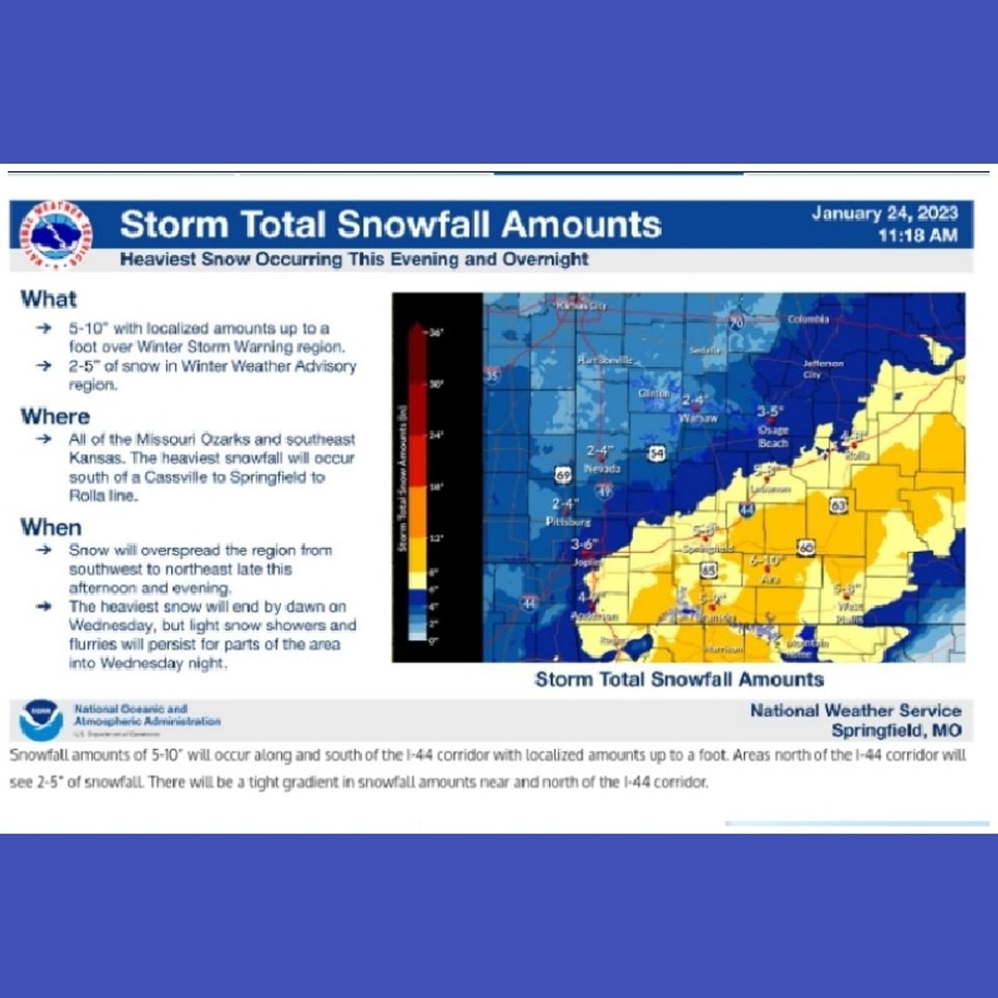
As the most inspirational snow Monday January 23 2023You're listening to weather with enthusiasmit's Monday evening and we have something which is totally amazing that's going on in the South Central States really the southern plains. Those of you that do not realize how amazing this is, that's because you're lacking some information in regards to the storm. The way to get a six and snow storm here in the Midwest and in the Southern Plains has always been you need three ingredients. You need an Arctic airmass or at least a cold strong high pressure system, deep low pressure and copious amounts of Gulf moisture. But here we are. And we're lacking one of those ingredients and forecasters are calling for six to 12 inches, at least 10 inches over the Northwest portions of Arkansas. This is totally amazing because over the past several January's over the past several January's when we had the arctic air locked off. It was locked up just the arctic air and the plain arctic air January of 2020. Jan, even 2021, even 2022 When those things were happening, the precipitation was falling as rain even in places as far north as Chicago. It used to be that it was given in the month of January on the backside of any storm system. You could always expect snow regardless of whether there's arctic air or not arctic air. The question is will you have a major winter storm but then in recent January's that criteria that was gone, it was totally taken away. And the precipitation would actually fall as rain storm systems with lots of moisture would fall as rain. Even in northern cities. It was quite amazing. Actually, I don't know which one's more amazing. But after experiencing that for so many January's here we go with. There's not even a cold airmass. Behind the storm. There is a cold game as well behind the storm but not feeding into the storm. The storm is producing its own cold air, it's bringing cold air down. It's called dynamic cooling. When the precipitation gets heavy enough, this is what dynamic cooling is we have two things going on. We have evaporative cooling, which sometimes the National Weather Service will call wet bulb cooling. And we also have dynamic cooling, and the two are coming together to produce a major snow storm in the deep south, southeast Oklahoma is getting more snow than the northeast Oklahoma. This is you know it's starting off as rain in the morning. The only thing that's going to change in the afternoon, there's not any cold air coming into Oklahoma not at all, yet temperatures are going to be dropping through the day, and the precipitation is going to change during the afternoon. The fact that the sun is going to in fact that it's daytime is irrelevant. What's happening is like this we have precipitation light or moderate in the morning. Because it's light or moderate. We are back into a situation where we're back to reality we don't have cold air temperatures will be in the low 40s. The precipitation will be falling as rain, the precipitation picks up and intensity in the afternoon. And as it does so it brings cold air aloft cold air from all the way up in the atmosphere comes down with the precipitation because it's so heavy, it knocks the temperatures down. And then on the surface, we have another problem that the surface temperatures yesterday were measured to be between 40 to 50 degrees within one inch down into the ground. So we're gonna have a very hard time having that snow accumulate. Another difficult thing is to keep the snow as slow. Even when you bring the cold air down. The surface temperatures are just warm enough to melt it. But we have something else taking place which is the evaporative cooling. And the evaporative cooling is when the air slightly dry perhaps on the surface as the precipitation evaporates initially, the temperatures are going to go down even on the surface. So we have cold air with no source. The only source is the storm system itself. And this is happening in southern states, a place that we ordinarily would never expect something like this to really be happening. And so fall accumulations are expected to be a solid especially in the Ozarks, the Ozarks that That forecasters are calling for six to 10 inches, probably some higher spots as well, you also have to realize Oklahoma just because it's Oklahoma, you could always pull off a clap of thunder. And should that happen, you're gonna have localized spots of several more inches of snow. So this is going to be a wet snow. It's something which it's a, it's a day though, maybe these forecasts are treading very dangerous waters for forecasters that want to keep their eye the reputation of accuracy. Because if anything should go wrong, the forecast turns into a bust, we do not to reiterate, just to reiterate, we do not have arctic air feeding into the system. Not only that, we do not have a cold airmass feeding into the system, either. There's not even a cold front, there's no frontal boundary fitting into the system. This is completely based upon dynamic cooling, and evaporative cooling, the two are going to come together to produce heavy snow, it's all about the precipitation rate, wherever it has nothing to do with whether you're North whether you're south, whether the sun is out whether the sun is not out, it has to do with how heavy the precipitation is, and your closer to the moisture content, the heavier the precipitation is going to be. And that's when the precipitation changes over to snow, we're going to have a mix, whenever the precipitation lightens up, it will immediately change over to rain because there's just not enough cold air. Another thing going with this storm is that there is no warm nose. In the storm. Sometimes there's like a dry slot in the middle of these snow storms, that causes the snow to change over to a drizzle or something like that in the middle. Now with this one, this is a straight A total precipitation, it will be precipitating the entire time. This is really, it's kind of like an inspirational event. In a certain way. It's also comforting, it's comforting to know that January is back to where it was in the way it should be. This is a little bit it's a little bit far south for something like this to be happening. This is something that you can't blame climate change. It's first of all, we have nothing extraordinary going on. We have a heavy snowstorm in the South. It's extraordinary to those people who understand the synoptic set up that is producing this. But one thing is that climate change, you can't blame this on climate change. Because the only time you could blame cold air on climate change is when it's a result of the stratosphere warming, which is what causes all the arctic air to come down south. The Arctic is locked up north. And yet the upper atmosphere is cold. It's cold enough to it's very cold down there. And we have dynamic cooling, you know if anything, this is it's comforting. It's almost like the people who are worried about climate change. This is a this is a time this is a type of snow storm. Or actually, this is it actually shows perhaps in that area. We're not seeing for the time being this storm is not being affected by climate change. The only thing however, maybe the whole strange, the whole strange synaptic setup the whole thing. It is a strange thing. I think it's very strange thing. It is happening in an area that's deep in the south Texas, Oklahoma, Arkansas, and there's no cold airmass feeding into the system. And still happening in previous January's we had stuff like this happening way up north, even in Chicago and the precipitation would fall as rain. And we're also the forecasts right now are calling for more than six inches of snow. As the storm system moves east, eventually it is going to collide with with what's called the northern stream, which is going to collide with colder air that's when it becomes more of a normal system. And it becomes more for castable as it moves east into the Ohio area. And you get for that you know then you have to deal with is the is the air cold enough for it to snow altogether. This air that's feeding into the system. If you don't have the dynamic cooling of the precipitation is not going to be heavy enough. And we have to deal with is the air cold enough and the backside of the system to be producing snow right now in Oklahoma and Arkansas. The precipitation is going to be heavy. We're going to have dynamic cooling. That's the forecast. The fact that surface temperatures are currently 40 degrees or even higher. All of that is going to all of that will be going to be overrides can be overridden by all of that. The least in the Ozarks. I'm sure these forecasts are questionable you're gonna have it's you're going to have a wide range of snowfall accumulations with the system, all because there's so much which is dependent upon struts Small variables and you could the forecasts are calling one to six inches in some areas. Some areas just up to six inches, anywhere from nothing to six inches in some areas. The Ozarks you happen to have temperatures a little bit colder there. And in that area you it's a more solid forecast of probably around six to 10 inches, maybe even some isolated higher amounts. We have lots of children in this world and these areas do not get snow so often they don't get snow of this magnitude so often and this type of snow is certain to produce snow days in places down there and I'm sure they are very excited about this and we wish everyone good luck and have fun and have a wonderful night and a wonderful day for tomorrowYou have been listening to the podcast weather with enthusiasm.Become a supporter of this podcast: https://www.spreaker.com/podcast/weather-with-enthusiasm--4911017/support.
1-22-23: At Least Two Winter Storms cross the Midwest over next 10 days --- Support this podcast: https://anchor.fm/weather-with-enthusiasm/supportBecome a supporter of this podcast: https://www.spreaker.com/podcast/weather-with-enthusiasm--4911017/support.


