Discover Weather With Enthusiasm

Weather With Enthusiasm
Author: Simcha Lefton
Subscribed: 0Played: 44Subscribe
Share
© Simcha Lefton
Description
This podcast focuses on weather extremes and the way this interacts with weather forecasting. International weather is included during very hot weather but the main focus is the USA -usually the midwest and often the east coast. Some podcasts are entertaining with sound effects.
380 Episodes
Reverse
10 day Weather Outlook : made 12-14-22.
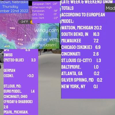
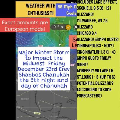
12-18-22- Forecast covers Erev Shabbos Chanukah. Holiday weekend. Blizzard Friday December 23rd. After the fact: A major winter storm broke records in Cincinnati with the area officially hitting blizzard status for a few hours overnight Friday.
History was made during this storm. The Greater Cincinnati area officially hit blizzard status overnight Friday with three consecutive hours of snow or blowing snow, wind gusts over 35 mph, with 1/4 mile visibility.
It also broke the record for the greatest six-hour temperature drop with temperatures dropping from 41 degrees to 2 degrees. This is the first time Cincinnati officially hits blizzard status since 1978
---
Support this podcast: https://anchor.fm/weather-with-enthusiasm/support
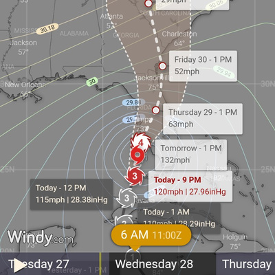
11pm EDT 9/27 Update on current Major Catagory 3 Hurricane Ian as it approaches Florida.
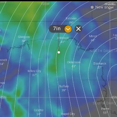
This podcast is in the top 10 in regards to popularity as of 12-9-22. Snow fell at the rate of 6 inches an hour at times. 81.2 inches was the peak accumulation. More than 3 feet at the official reporting station in Buffalo, 40 inches fell on Friday and Saturday alone. This Lake effect snow event had 2 parts. In general it lasted from November 18th - 20th 2022.
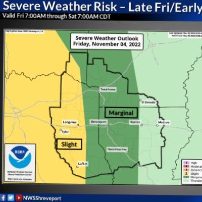
This podcast is in the top 10 in regards to popularity as of 12-9-22. 11-2-22: Unseasonable Warmth replaced with heavy Snow (or continues). Entire U.S. synopsys. In this podcast we mentioned Cincinnati ohio, Tampa Florida, St Louis Missouri, chicago, Scottsbluff Nebraska, Palm springs California, Fairbanks Alaska, Valdez Alaska, Salt Lake City Utah, Shreveport Louisiana, the Plains, Minnesota, the Midwest, the Northeast, the southeast, the desert Southwest, the Pacific Northwest, Alaska.. We discuss the 80° temperatures in the plains the record heat taking place in Florida and the Midwest. Record consistency of warmth may be happening in many cities. The very cold air behind the front will disappear as it moves East. Consistent warmth in the East. Roller coaster for the west and the plains. Over 3 ft of snow in South Alaska. Severe Weather Outbreak over louisiana, texas, and Arkansas for this Friday afternoon and Friday night. An intense wind storm expected in the plains this weekend including blowing snow for Scottsbluff nebraska. More of these details (and more) are discussed in this podcast. Enjoy!
October 23rd: Blizzard with Summer Heat in Midwest
(Ranks in top 5 in popularity) 90s in Arctic as seen in the image. This podcast was made just before the 90s were discovered. It speaks about an Alaskan heat wave forecasted by the National Weather Service for this week and the Northwest Pacific Heat Wave early this week. It also covers the unseasonably cool weather in Northern Texas. The heavy rain for the Northeast on Monday and the dust storms for the desert Southwest. Other weather for the U.S. is included as well.
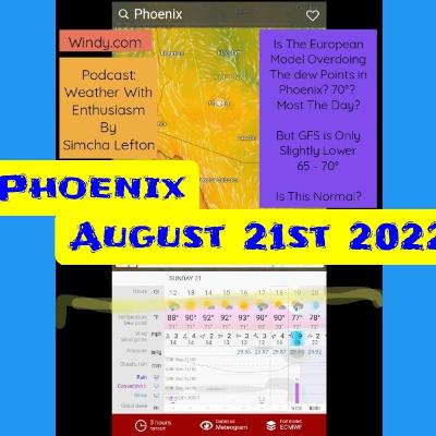
Hurricane drought continues....lengthy Phoenix discussion.
United States Weather (all the fun) :made August 9, 2022
This podcast discusses the hot to very hot weather occurring in the desert southwest and northern intermountain region, how the severe weather potential over the Midwest moves to the east coast on Friday, the 4 consecutive days of highs from 86° (over soil moist grounds but climatology supports 90° for St.Louis despite soil moist grounds) to 96° (mid 90s where downslope winds occur or larger cities or lower dew point air (Baltimore and Philadelphia are the cities in mind) over the Midwest and east coast, connection between soil moisture and little if any climate change, how soil moisture is having a clear impact on dew point this year and how this will reduce temperatures in midwest for the upcoming heat, upslope winds increase temperature for Baltimore, the backdoor cold front that may overtake Boston on Tuesday (see podcast picture) or Wednesday but heat returns for Thursday (even Boston), the large contrast in temperature over North Dekota expected Tuesday, the severe weather outbreak for North Dakota expected Saturday. This podcast comes with background music in order to enhance the experience of "suspense" and an entertaining song at the end. It will be interesting monitoring the temperatures in Massachusetts next week especially since both the coldest and possibly even the hottest temp may occur in that state. Hope you all enjoy!
Unknown 0:16
Good afternoon, everybody. It is Friday, October 15. And we have, we're going to discuss a weather synopsis for the United States. We're going to start off there's four different air masses that are influencing our country. Big time. Let's start off with number one high pressure systems situated over Georgia this afternoon, we'll be continuing to move south east right off of the coast by tomorrow morning. This high pressure system is pumping a South flow of warm and even humid air up the East Coast bringing well above normal temperatures. In fact, this is unseasonably warm heat. A double in fact, this is a late summer season weather pattern that's happening on the East Coast today. Temperatures might be breaking records south of the Mid Atlantic area, perhaps in North Carolina or South Carolina. But when you go up further north records probably will not be broken but it will be warm. With high temperatures in Baltimore, mid May be upper 80s, Washington DC, mid 80s. Philadelphia, probably low 80s. And tomorrow, we're even going to continue to see temperatures probably low 80s for Baltimore, even 80 degrees for Philadelphia tomorrow, but a sea breeze will develop in Atlantic City highs only in the mid 70s. Let's go back to today because I just want to know, what is the audience feel? What do you feel about temperatures being in the 80s? Those on the east coast? It's like late summer it's like not too hot, but it's just amazing.
Unknown 1:49
What do you guys feel? That is his complaint, her response? That's what I thought because that's what I would feel. It's hurray for sure.
Unknown 2:08
But you know, in Baltimore, I want to know, oh, this is but how do you guys feel in Baltimore over the fact that it's almost going to be warm enough to break a record? But not quite. Yeah, I love breaking records. And that's just too bad that we don't get to break a record. But it's gonna be warm as we said, nonetheless. I want everybody to realize the following. This is a very unique in the Chicago Tribune. It said the coldest temperature yesterday was eight degrees and it occurred. Get ready for this. Get ready for this one.
Unknown 2:56
It occurred 37 miles south east of this little town in Utah. The newspaper I don't remember. But the newspaper mentions the little town. Now I want to know. Like if it reached if the warmest temperature yesterday was in St. Louis, with the newspapers say the warmest temperature was 300 miles southwest of Chicago, Illinois. It would just say the actual town. So why does it say 37 miles south east? Why would it do that? Again, it wouldn't do that by Chicago or St. Louis. Why would it do that then? Isn't that strange? That really is strange. That needs a tremendous explanation. Where who has this weather station isn't in someone's on someone's roof. Like what? Where is it? What how come this place doesn't have the name of a town. The Chicago Sun Times agrees but the temperature the coldest temperature in the US was eight degrees. But it says it was in body Park, California. They actually have some clarity
Unknown 4:11
I know it's so nice to have clarity. But you know what it's nice to do this is to have clarity. It's so awesome to have humor to have humor that Chicago Tribune 37 Miles Don't you want to check we need requires like an investigation. And I hope you're listening to the instruments in the background because you know, it's definitely requires an investigation and those that those instruments in the experience over here, don't they? Now let's go ahead and pull ahead with the warmest temperature in the US now that we mentioned the coldest the warmest temperature was in Falk in Lake, Texas. Once again, Falcon Lake Texas with a high temperature
Unknown 4:58
of I completely forgot what the high temperature was. I think it was 102 degrees. If it was 102, what is the audience feel about that? About a being 102?
Unknown 5:24
No response, no response, I guess why should that get a response?
---
Support this podcast: https://anchor.fm/weather-with-enthusiasm/support
Unknown 0:10
Good evening, everyone, it is Wednesday, October 13. And here is the weather synopsis for the United States. And first, I want to say that if anyone's interested in hearing just a quick weather synopsis with the forecast for Chicago, you can go to my other podcasts, it's just called Quick weather synopsis. And you can hear that it's was made this morning, this is more of an in depth discussion. That's what's gonna be going on on this podcast right now. We have probably the most dynamic part of this weather or the the system that's creating the most significant weather over the largest part of this country is a deep low pressure system located in South North Dakota. barometric pressure is 29.2, it certainly is a deep low pressure and the storm system is moving in a unique path, it's moving directly north and is headed into Canada, Manitoba. The system is going to weakened slightly but remain a deep low pressure system, it's going to weaken to 29.3. And it's going to continue to move directly north. It's not moving northeast, north, north east, slightly northeast, but really, it's taking the most intense track possible to produce heavy snow. This is what the North Eastern a lot of times do. There's also a call flow which moves right up the Mississippi River. And when that happens in the winter time, that's when the heaviest snowfall occurs. So there's no question we have cities also that have responded to this their cities in Montana. But as of this morning, one city got 28 inches of snow, another one. That's somewhere in the 20s others in the upper teens, and I believe the snow is still falling with an additional eight to 12 inches expected in some spots, the names of those cities, you could look up, I had the names, but it's going to create too much of apsic in this podcasts going to create an interruption here, so I'm just gonna leave it at that. And we also that low pressure system is producing other hazards as well. As I mentioned this morning, as severe weather outbreak is also on the side of that system on the south east side is it usually is now originally the Storm Prediction Center put Chicago and a marginally
Unknown 2:34
chance for severe weather about a 10% chance. But that line moved further west. Now here's what's happening over here, because there was something that changed the major variable that changed, which is very much no gear has tremendous connection to the Chicago weather. And it's the exact opposite of what happened this past Sunday. And I want to explain that as well, because that requires an explanation. And I'll tell you why it requires an explanation in just a minute. The low pressure system earlier today, that storm system had a lot of forcing to it and the storms were developing right along where the warm front and the cold front came together. And that also where there was a lot of forcing a lot of energy in the upper atmosphere producing thunderstorm development, lots of lightning report in Missouri and in Iowa, the thunderstorm development continued moving east and Northeast away from where the most intense forcing is away from the intense low pressure system. And therefore the thunderstorms gradually reduced the gradually weekend. And they continue to weaken. And that's why that's one reason why as it reaches Chicago, we may not even have too much thunder, although there probably will be a little bit of thunder. The other thing is that it's going to be the system is moving much slower than originally thought both the warm front is moving slower and the cold front and the warm front, the warm air isn't going to get here until tonight. And then the cold front comes tonight. So the whole system is arriving in the middle of the night. The middle of the night is not an ideal time for thunderstorm development. Nonetheless, there could be thunderstorms in our area here in Illinois. And as you go further east, though, the chances for storms kind of decrease. Except it's already moving so
---
Support this podcast: https://anchor.fm/weather-with-enthusiasm/support
Unknown 0:31
Good afternoon, everyone. It is Sunday, October 10. And we are in the midst of living through an unprecedented event for the month of October for us who come from the Midwest. We're actually going to this event is going to intensify as the week goes on. We have not dropped below 60 degrees yet this month of October, it's already October 10. Temperatures have failed to fall below 60. Now, why have they failed to fall below 60. So someone might want to say that. You know why? Because the daytime highs were around 80. Well, you know, if the daytime highs were around 80, then we would be talking about another unprecedented event for temperatures to be 80 degrees for the first 10 days of October. Certainly the temperatures were 80 degrees i We could hear why The overnight lows did not drop below 60. But when you look back last week, and you see those daytime highs are 68 degrees, 67 degrees, 69 degrees. And then you look at the overnight lows, 65 degrees, different 60 This degrees and 60 degrees, you have to wonder what is going on here, we have the nights are 13 hours long, temperatures start dropping even before skier even before sunset, the temperature start dropping, so we have 15 hours of dropping temperatures. So 15 hours of dropping temperatures we had one day the high was 68. The low was 65. But that was so okay, that doesn't. Let's say the high was 68. And that night, let's say it was 63. Let's just say I think it might have even been less than five degrees, you have five degrees within 15 hours. So we're talking about dropping one degree every three hours. So a third of the degree in our What can possibly be causing that a third of the degree in our? Well, the answer is the dew points, the dew points, the humidity, the humidity is tremendous insulation here in the city and the temperatures are just not dropping, they can't drop below the dew point and the humidity stays. Now why is there so much humidity and why so much consistency. I don't even know if we see such consistency in July. And we do we do see consistency in July. But even in July, we do get these Canadian air masses every now and then we're dew points dropped into the 50s. In fact, at the very end of July this year, dew points dropped into the 40s. But we've seen such consistency like this is just 10 days temperatures have not dropped below 60 Dew points have remained above 60 degrees. And the question again is why? So I've read in an article something very interesting. It's because the sun is so weak, the wetness of the ground is just not evaporating and significant pace and therefore the dew points remain high. It is the weakness of the sun that is causing all the warmth right now, we still have vegetation all over the place, the growing season is coming to an end for many places out west. Even in the southwest, hard freeze warnings are in effect. And the National Weather Service leaves off with the forecast discussion they sign off with. And this brings the growing season to an end. It's like it's sad words to hear. Because once the growing season comes to an end over there, and it comes to an end in the northwest Pacific and all around us to the west and eventually to the north. Then the humidity starts to die down once the humidity starts to die down over there, even though the humidity continues over here. But the jet stream is going to gradually start to move south. That's what's going to start to happen. There's a question, there's a major question. Is it cold? Because the Jets is the reason why we're warm? Let's say the reason why we're warm. Is it because the jet stream is above us? Or is the reason why the Jetstream is above us because we're warm. And they say nobody knows. It's like asking what came first the chicken or the egg? Nobody knows. And it's really kind of like a combination of the two. It's a combination of the two. So in a certain way I think it is the humidity that is keeping the Jetstream further north. In fact humid, hu
---
Support this podcast: https://anchor.fm/weather-with-enthusiasm/support
Unknown 0:02
Good morning everyone. It is August and then it's in the late morning and today is finally here an exciting day because it is extremely humid outside and the dew points are really really high. This is a rarity here in the Chicago area. Right now the state of Illinois is the most human state in the country and we're seeing dew point, the maximum dew point in the past 12 hours was a sauna like 84 degrees. It's reporting on one website. Dark Sky says that parts of the Chicago area currently have a dew point of 81 degrees. The National Weather Service weather app says the dew point 78 degrees. Other sources say that the dew point the official dew point in Chicago 76 degrees. Midway according to one side says the dew point 74 degrees. So we certainly been a hard time trying to figure out what the dew point is here in the Chicago area. But either way, probably the strongest indicator that we actually do have dew points currently in the Upper 70s and even low 80s low 80s. Imagine that low at dew point is from the National Weather Service Forecast discussion, where it says the dew points today will remain in the Upper 70s and low 80s remain meaning they have gone up into the upper 70s and low 80s accuweather.com is reporting maximum dew points to be occurring late this afternoon at 79 degrees, and they have their models a little bit off for right now though what do they say the dew point at noon will be 71 degrees, but it's already in the Upper 70s. But either way, perhaps there are places in Chicago where the dew point is only in the low 70s. And perhaps each weather station is reporting a different viewpoints. But by late afternoon dew points will be in the upper 70s. And the National Weather Service has pointed out that there will even be some locations with dew points in the low 80s. This is as high as it can possibly get. The record for Chicago has a dew point of 83 degrees. That's the highest dew point ever recorded in Chicago. So we are approaching record territory here. And what's amazing about this is that it's not just we're approaching record territory, but it also the highest dewpoints in the country are occurring right over the Chicago area. Now South Bend Indiana also is having very high dew points a little bit less than the Chicago area. dew points between 75 and 76 degrees. dew points will likely go a little bit higher as the day progresses. He didn't afternoon he didn't disease top out between 95 and 105. For South Bend, Indiana. He didn't he's expected to be around 110 area wide in the Chicago area. Heat advisories in effect for Chicago possibly for South Bend as well until 7pm this evening. Now the one variable that is might mess up this heat is if thunderstorms develop this afternoon. As of now the thunderstorms are expected to hold off until this evening. Some of those storms could be severe, especially with damaging wind 55 to 65 mile per hour wind gusts with an AccuWeather max of 80 miles per hour. There also could be an isolated tornado and large hail. But the main thing will be the damaging winds with these storms. And it's unbelievable the amount of humidity obviously the amount of humidity these storms are dealing with is the highest in the world. This is as intense as it gets really probably on par with the monsoon in India. Just about you know for a week the dew points for between 80 and 81 degrees in New Delhi, India. We're seeing two points here that are places currently dew points are in the low 80s. And parts of Illinois as we speak. And the maximum dew point I don't know if this is official or unofficial was 84 degrees within the past 12 hours here in Illinois. dew points elsewhere in the country it is very difficult to find an 80 degree dew point unless you go down into Galveston, Texas or Corpus Christi, Texas, otherwise plenty of Upper 70s. Lots of Upper 70s. For dew points. There's an 80 degree dew point here and there in the Iowa area.
Unknown 4:16
dew points of 80 degrees and tempe
---
Support this podcast: https://anchor.fm/weather-with-enthusiasm/support
Unknown 0:06
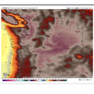
Good afternoon, everyone. It is Shiva also Thomas. It is Sunday, June 27. Early in the afternoon, and we have monitored for real, like an unbelievable weather pattern, an unbelievable weather situation that's taking place up in the Pacific Northwest and in southwest Canada. In fact, it is so unbelievable. There's a meteorologist and perhaps even more than one Cliff maths who said that if it wasn't for the fact that every single computer model is forecasting the same thing, this forecast would be completely dismissed. It's just completely outrageous what's going on. You know, it's kind of like what it was forecast in Denver many months ago. According to the GFS computer model, where they were forecasting more than 50 or 60 inches of snow, the meteorologist just dismissed it because it's just not possible. It's like totally outrageous. They went ahead and went with the other computer models which were forecasting much less either way, it was a major snowstorm. But sometimes you'll have a computer model which is forecasting something outrageous, and the meteorologists know just ignore it that for whatever reason, that particular model is forecasting something really weird. In this case, the it is totally outrageous what is being forecasted. The only thing is, is that every single model is forecasting the same things, even some of the European computer models, which is completely different. It's made up of completely different material, completely different sensors completely different everything from the GFS model, it's still reaching the same conclusions as the GFS model and other models in regards to the Pacific Northwest and southwest Canada, there's this is probably the they say this is the strongest dome of heat that has ever occurred. And this is also a KERS once every 4776 years, that's on average, those are the chances of something like this happening is one in every 4776 years. There are different opinions in regards to how much of this is connected to climate change or not. We have Cliff mass who feels that this heatwave would be happening regardless of manmade climate change. This is just so so intense, that even without the manmade climate change, he says we would still have an extreme event, he thinks that it perhaps there's climate change that is contributing to a couple degrees, making it a couple degrees warmer than what it ordinarily would it would have been otherwise. But even without the climate change, this is what had happened. And it would have been an extreme event. We have other meteorologists and climatologists who claim otherwise, they say that this completely storm of heat, the whole thing probably would not be happening if it wasn't for manmade climate change. But I would assume nobody really knows, I would assume that it's just going to leave it off as a my focus is different of opinions, different approaches as to how much of this is connected to manmade climate change, if any of it is but in any case, we do have a an an unbelievable thing. Unbelievable dome of heat that's taking place up in the Pacific Northwest. Temperatures are expected to hit 110 degrees and Seattle Washington today.
Unknown 3:37
I do want to acknowledge that, based upon an article that I read, it could be implied that temperatures do reach 110 Every now and then at least for areas along the Cascades and eastward. But for temperatures to reach 110 degrees west of the Cascades, that's basically unheard of. We have temperatures that hit 108 degrees. I think it was in Portland, Oregon, or very, very close to that yesterday. Temperatures, I believe went up to 102 and Seattle, Washington yesterday. These are all records temperature of 110. Today that beats the old record by 19 degrees. The previous record was 91 degrees. Who's ever heard of such a thing, breaking a record by 19 degrees? You know, we almost came close to stuff like that back in the March heatwave of 2012. That also was something that was just so outrageou
---
Support this podcast: https://anchor.fm/weather-with-enthusiasm/support
Sharing words from the NWS
Chanuka storm potential in Midwest Full Episode
Enthusiastic delivery of 7-day weather synopsis with likely improved accuracy due to better communication about the weekend system.
This episode makes reference to several National Weather Services throughout the country. This includes New York, Buffalo, St.Louis, Kansas City, Chicago, Midland TX Bismark, N.D.
In addition, this episode contains info from the National Weather Service in Holley, N.J., New Orleans, South Bend, Cleveland, Norman, OK, Detroit, Milwaukie, and Duluth (or whichever one includes Lake Superior). Several other forecast discussions from additional forecast offices were used in preparation for this podcast. This includes Omaha, Des Moines, Green Bay, Wisconsin, Anchorage, Amarillo, TX, Ohio (the one that covers Cincinnati), and additional offices.
Additional resources used in preparation for this episode were 3 weather articles in the Washinton Post.
The computer models advertised on Windy.Com were also used in preparation, especially the European model. This is used together with the guidance offered from the forecast discussions of various national weather services.
The long-term weather forecasters mentioned in this episode are believed to be from AccuWeather. This episode incorporates previous knowledge that is known to the Podcaster from being a weather Enthusiast from the time he was three. Some of that information comes from meteorologists Dave Murray and Tom Skilling. Occasionally the New York Times. The enthusiasm expressed in this episode comes from the podcaster's natural love for weather and fascination with forecasting (as do all the episodes). Some of this love was transmitted from the human voice on the NOAA weather radio. The material in the Washington Post is frequently written by Mathew Cappucci. This one includes information from Dan Stillman and possibly others, especially Jason Samenow.
This episode adds clarification and has some additional info including a small discussion about El Nino. We discuss Google's new Forecasts made through artificial intelligence. It's more accurate than the European model. We make some comparisons between this week's weather pattern and a pattern back in January 2021 (and December 2019 and 2020).
Updated Weather with more details for week of November 19th 2023
11/7: Alaska Blizzard, Texas Record Heat


