


Breezy start to the week with rain chances through Wednesday
Description
A breezy start to the week is on tap as a large weather system brings periods of rain from Monday night through early Wednesday. After the midweek showers move out, seasonal temperatures will take hold to close out October.
Clouds increase from the west
Clear skies from Sunday will continue through the evening before clouds gradually increase ahead of the next weather system.
<figure class="figure figure-none figure-full"><source type="image/gif" />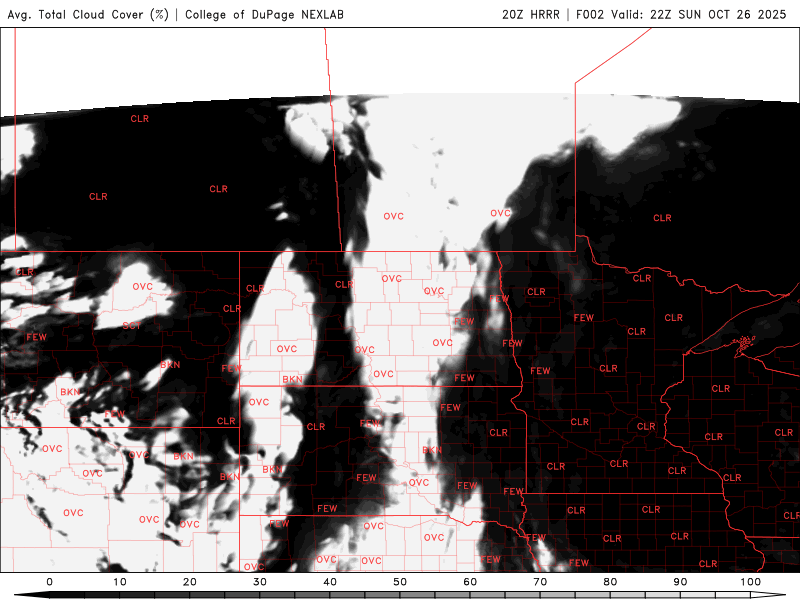 <figcaption class="figure_caption">
Western Minnesota will stay milder overnight with lows in the mid to upper 40s under thicker cloud cover, while eastern Minnesota will cool a bit more, dipping into the upper 30s to low 40s under clearer skies.
<figure class="figure figure-none figure-full"><source type="image/webp" /><source type="image/png" />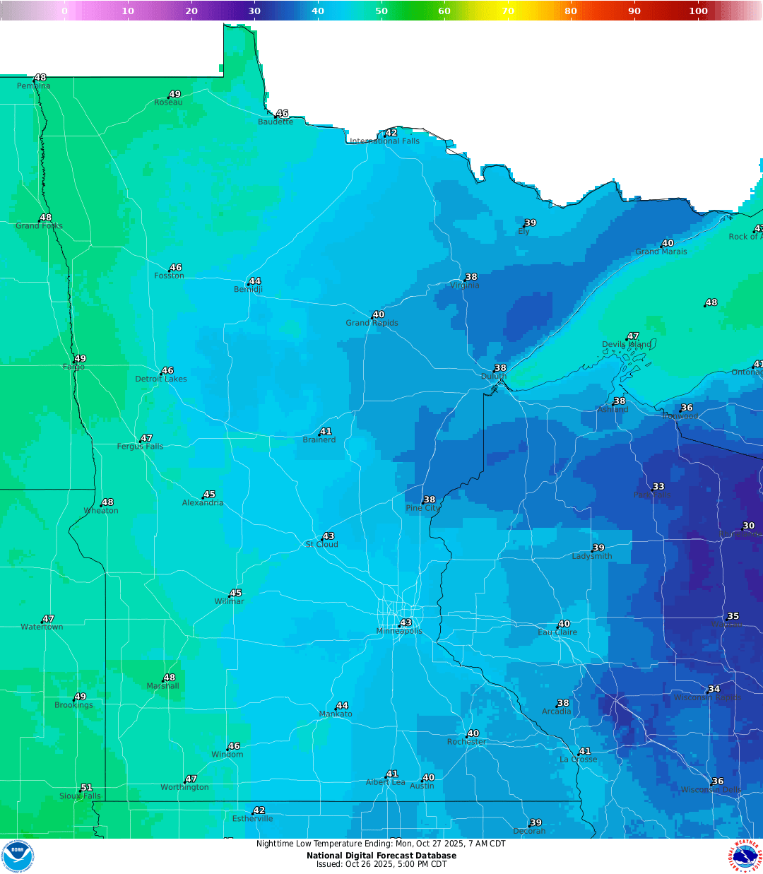 <figcaption class="figure_caption">
Winds will be breezy from the south-southwest at the start of the work week.
<figure class="figure figure-none figure-full"><source type="image/gif" />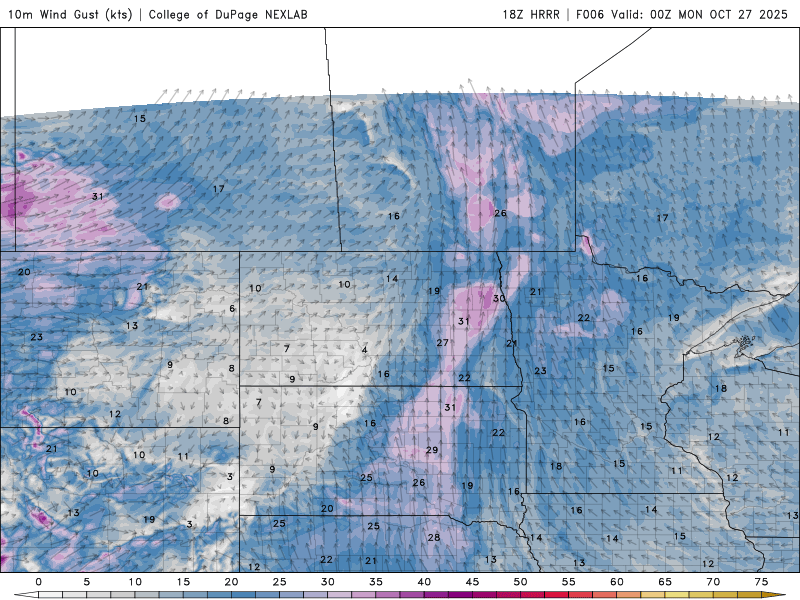 <figcaption class="figure_caption">
By Monday, temperatures will climb into the mid to upper 50s ahead of the approaching weather system.
<figure class="figure figure-none figure-full"><source type="image/webp" /><source type="image/png" />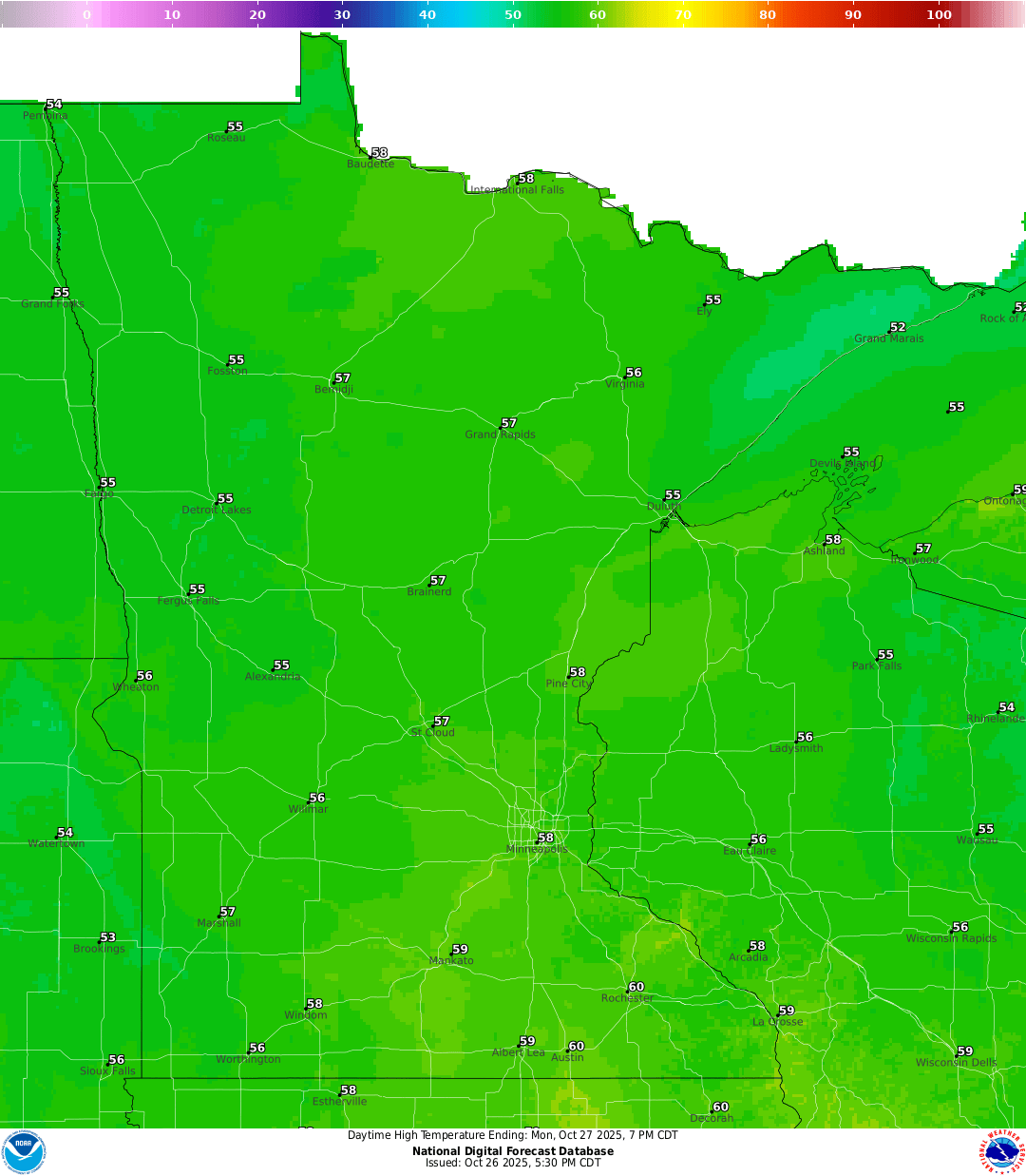 <figcaption class="figure_caption">
Rain chances will increase by late afternoon in western Minnesota, spreading eastward through the evening and eventually reaching the Twin Cities metro area later at night.
<figure class="figure figure-none figure-full"><source type="image/gif" />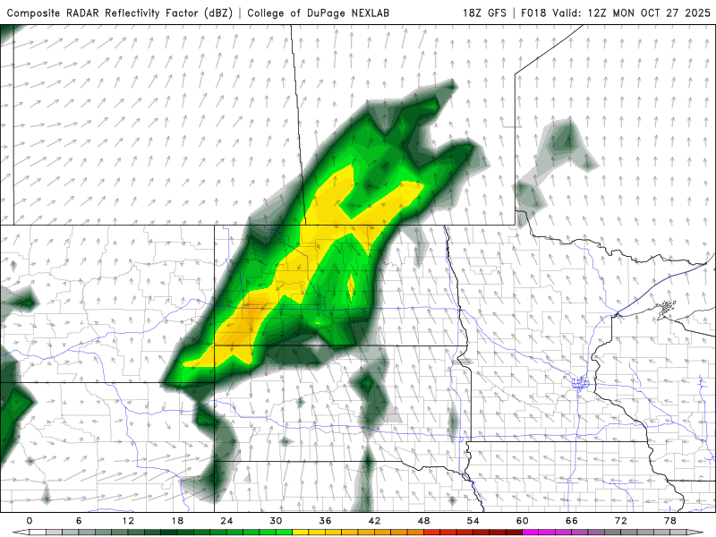 <figcaption class="figure_caption">
Rainfall totals will be noticeable, with most areas receiving around 0.5 inch, and a few isolated locations possibly seeing slightly more than an inch in northwestern Minnesota.
<figure class="figure figure-none figure-full"><source type="image/webp" /><source type="image/png" />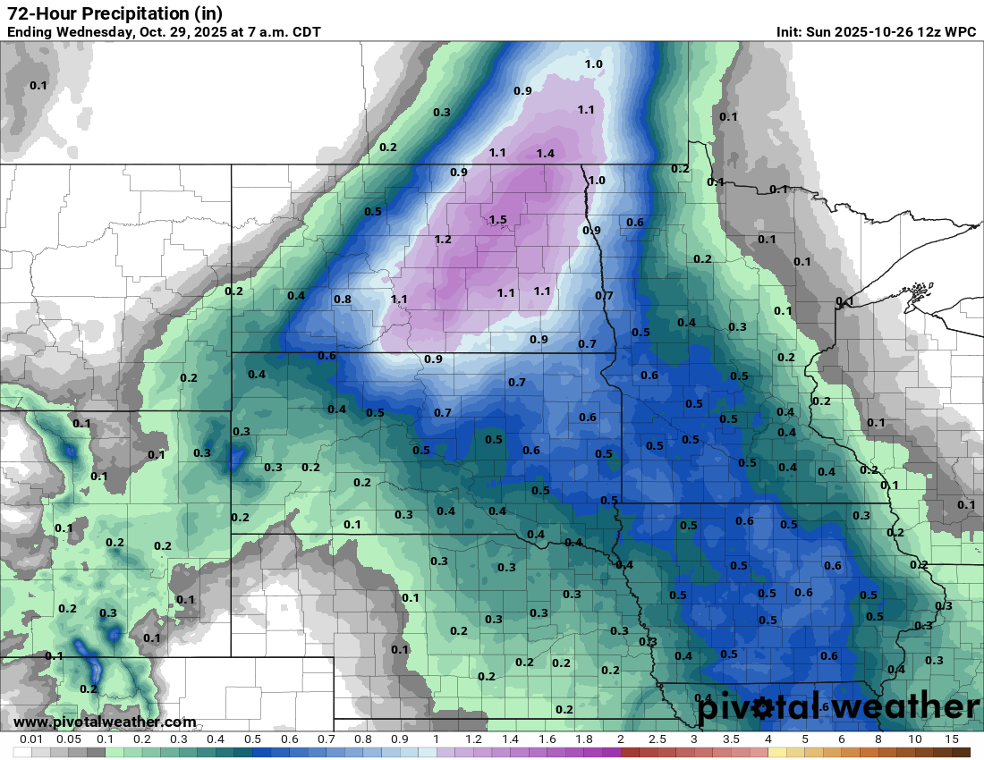 <figcaption class="figure_caption">
Behind the system, temperatures will remain near seasonal levels, with highs in the upper 40s to low 50s as October comes to a close.


 United States
