


Cold with frost likely in the Twin Cities this week
Description
I hope you savored our lingering late summer weather pattern for the first half of October.
<figure class="figure figure-none figure-full"><source type="image/webp" /><source type="image/jpeg" /> <figcaption class="figure_caption">
Temperatures ran about 8 degrees warmer than normal through the first 19 days of October in the Twin Cities. Our region has recorded a very warm start to the month.
The epicenter of our warm October so far has been in southern Iowa, where temperatures have been more than 10 degrees warmer than normal!
<figure class="figure figure-none figure-full"><source type="image/webp" /><source type="image/png" />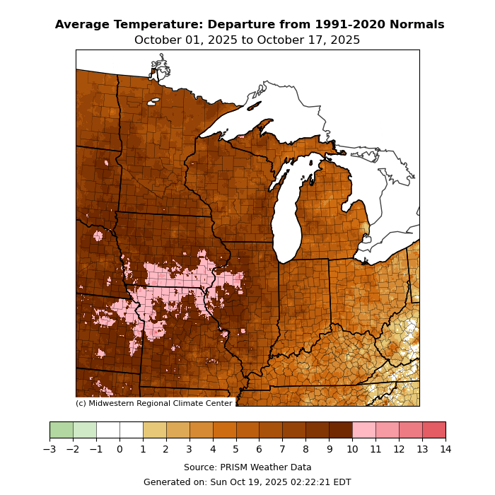 <figcaption class="figure_caption">
Our late, summery October interlude is all a memory as we move thought the week. A much colder and more seasonable air mass is blowing into Minnesota from Canada.
Wind advisories Tuesday
Tuesday brings gusty northwest winds. Wind advisories cover most of Minnesota Tuesday including the western Twin Cities. (Map at top of post) Here are the blustery details.
Including the cities of Le Sueur, Owatonna, Little Falls, Long Prairie, Elk River, Faribault, St. Cloud, Shakopee, Sauk Rapids, St. Peter, Chanhassen, Victoria, Gaylord, Albert Lea, Fairmont, Waseca, New Ulm, Mankato, Princeton, Blue Earth, Monticello, Chaska, Litchfield, St. James and Hutchinson
2:16 p.m. CDT Monday, Oct. 20, 2025
...WIND ADVISORY IN EFFECT FROM 11 A.M. TO 6 P.M. CDT TUESDAY...
* WHAT...Northwest winds 25 to 35 mph with gusts up to 45 mph expected. * WHERE...Portions of central, east central, and south central Minnesota.
* WHEN...From 11 A.M. to 6 P.M. CDT Tuesday.
* IMPACTS...Gusty winds will blow around unsecured objects. Tree limbs could be blown down and a few power outages may result.
Wind gusts Tuesday will exceed 40 mph, especially west of the Twin Cities.
<figure class="figure figure-none figure-full"><source type="image/webp" /><source type="image/png" />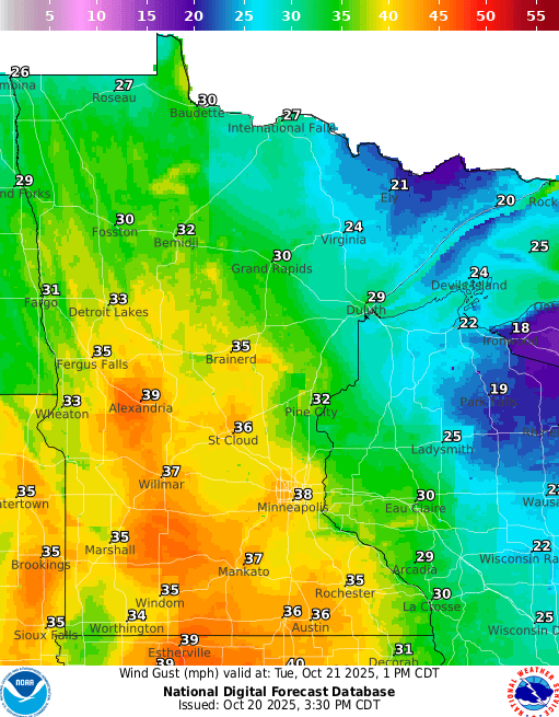 <figcaption class="figure_caption">
Frosty mornings ahead
Tuesday brings a reality check and resurrects a timely seasonal weather phrase once again: wind chill.
High temperatures will hover in the chilly 40s Wednesday afternoon.
<figure class="figure figure-none figure-full"><source type="image/webp" /><source type="image/png" />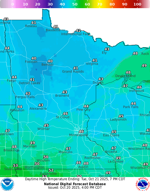 <figcaption class="figure_caption">
Wind chill values will make it feel like the 30s in most areas.
Keep in mind, the normal high and low for this week in the Twin Cities are 55 and 38 degrees.
Frost and freezing temperatures will be widespread this week in the mornings. The coldest morning looks like Thursday. Lows in the 20s north and 30s south.
The Twin Cities will plunge into the 30s, and we have a shot at hitting the season’s first 32-degree temperature at Minneapolis-St. Paul International Airport by Thursday morning.
<figure class="figure figure-none figure-full"><source type="image/webp" /><source type="image/png" />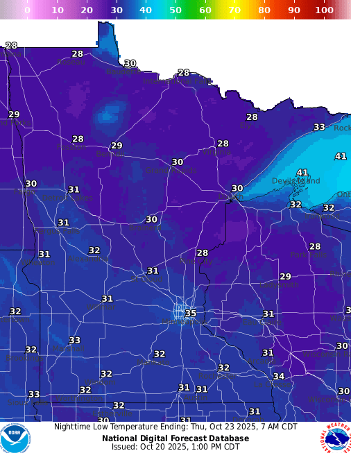 <figcaption class="figure_caption">
The coldest temperature observed so far this fall at Minneapolis-St. Paul International Airport was 38 degrees on Oct. 8. The average date for the first 32 degree temperature at the airport in fall is Oct. 18, so we’re past due.
Stay warm and classy, Minnesota.


 United States
