


Sun returns as temperatures warm and winds pick up
Description
Milder temperatures and sunny skies are in store for our Sunday, with increasing south to southeasterly winds. The new week begins on a wetter note, as rain showers move in and bring the potential for some healthy rainfall totals.
Bright, breezy and mild
A sunny start to our Sunday with warmer temperatures on the way. Highs will reach the low to mid-60s, with western and southwestern Minnesota climbing into the mid-60s by afternoon.
<figure class="figure figure-none figure-full"><source type="image/webp" /><source type="image/png" />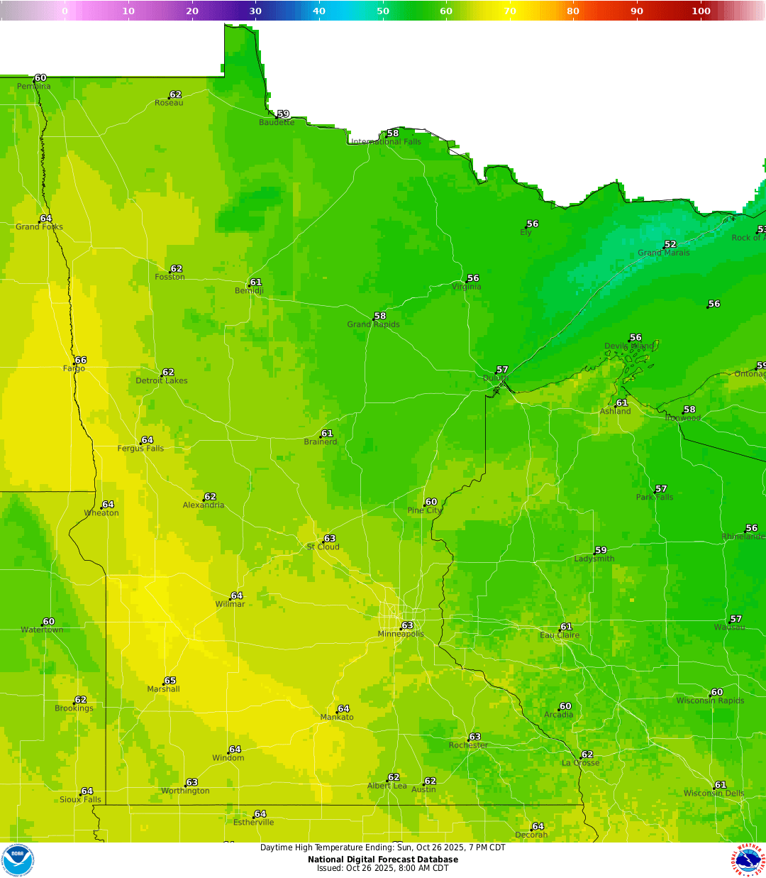 <figcaption class="figure_caption">
South-southeasterly winds will pick up ahead of the next system approaching from the Rockies. Eastern Minnesota can expect gusts of 10–20 mph, with stronger winds across western areas.
<figure class="figure figure-none figure-full"><source type="image/gif" />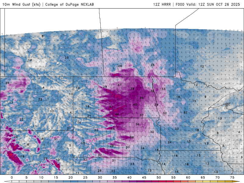 <figcaption class="figure_caption">
A wind advisory is in effect for northwestern Minnesota from 9 a.m. to 5 p.m. Sunday, with sustained winds of 25–30 mph and gusts exceeding 50 mph.
<figure class="figure figure-none figure-full"><source type="image/webp" /><source type="image/png" />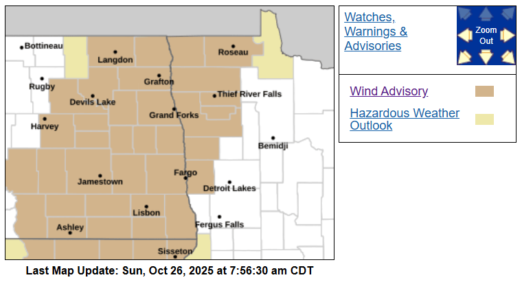 <figcaption class="figure_caption">
Clouds will increase Sunday night, keeping western Minnesota mild with lows in the mid to upper 40s, while eastern Minnesota will see cooler temperatures in the upper 30s to low 40s.
<figure class="figure figure-none figure-full"><source type="image/webp" /><source type="image/png" />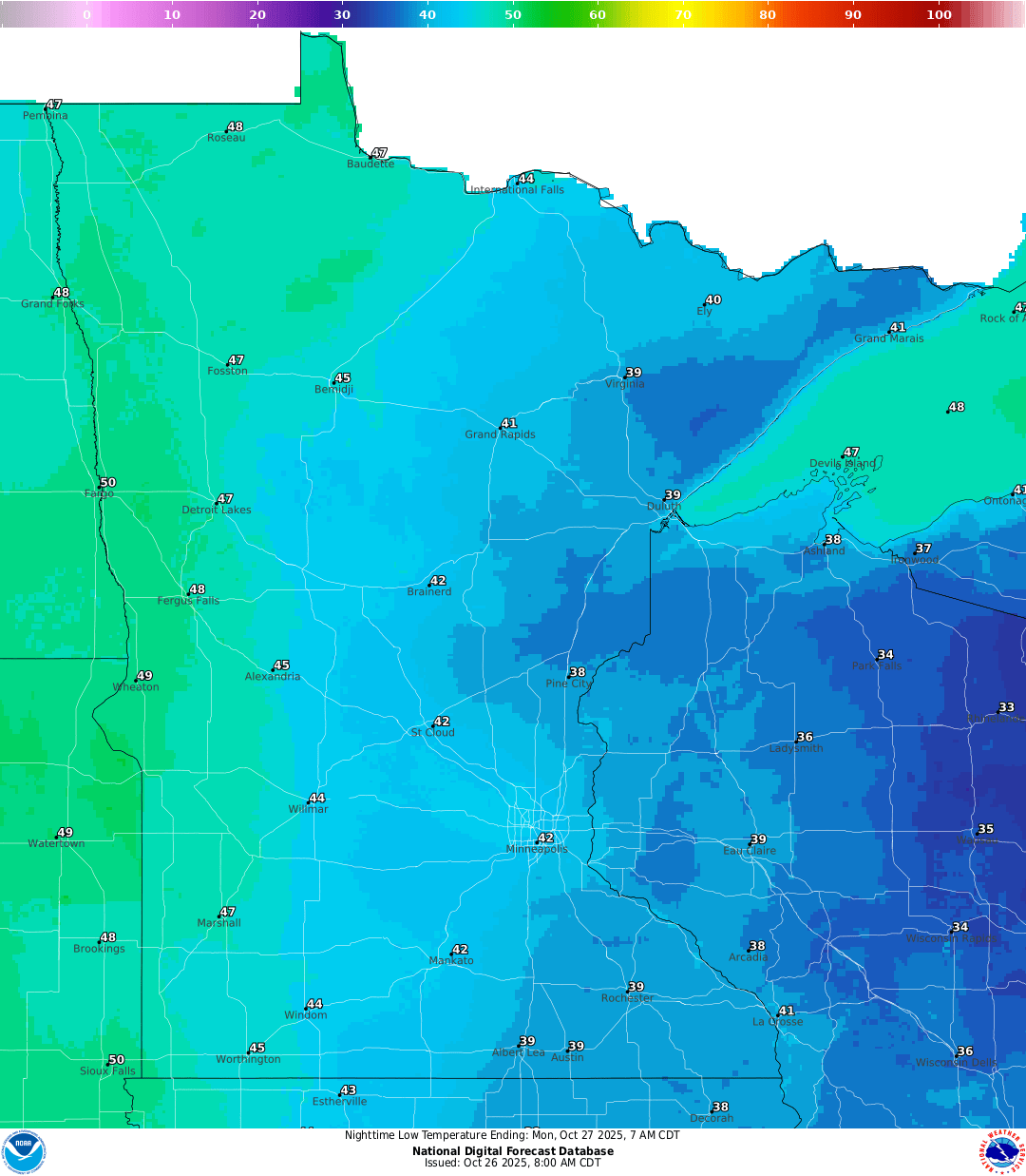 <figcaption class="figure_caption">
Rainy start to the work week
The forecast suggests a promising chance for meaningful precipitation totals early this week. Showers are expected to develop later Monday across western and central Minnesota, though some uncertainty remains regarding how far east they will reach.
<figure class="figure figure-none figure-full"><source type="image/gif" />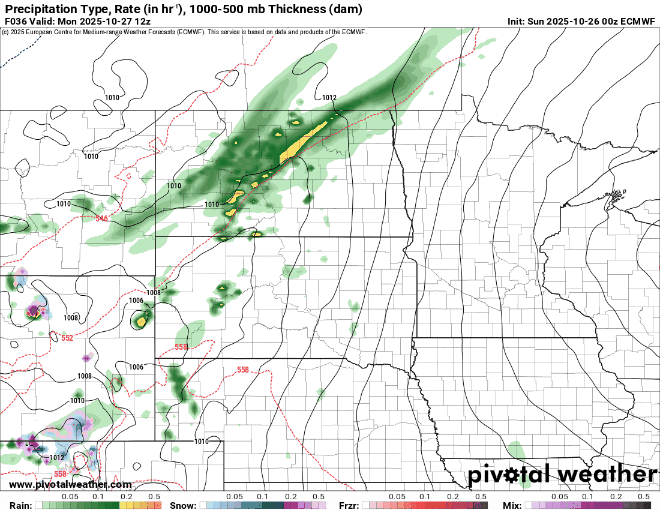 <figcaption class="figure_caption">
Precipitation totals are expected to reach up to an inch in western and northwestern Minnesota, with the lightest amounts across northeastern Minnesota.
<figure class="figure figure-none figure-full"><source type="image/webp" /><source type="image/png" />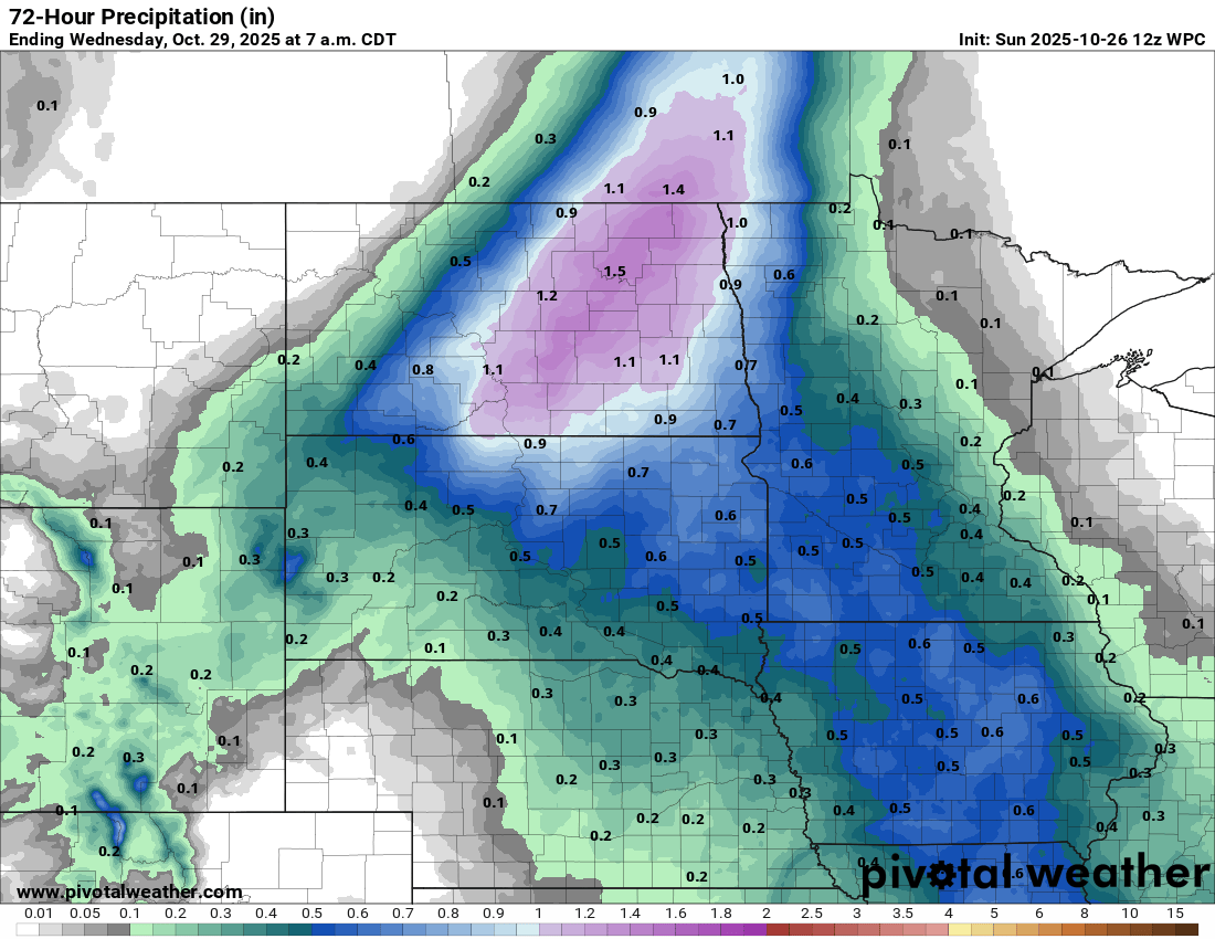 <figcaption class="figure_caption">
Rain showers will stick around Tuesday, finally ending early Wednesday. Temperatures behind the system will be seasonal, in the upper 40s to low 50s.


 United States
