


15. 合辑|Abercrombie的1944年战后大伦敦规划
Description
本期节目围绕1944年大伦敦规划展开讨论伦敦的城市空间和Abercrombie的规划技术,是第12和第14期节目的合辑。
我们首先从解读几个空间概念入手,他们分别是伦敦城(The City of London),内伦敦(The Inner London), 和大伦敦 (The Greater London)。 此外,节目还将关注城市规划师的角色和影响,探讨十九世纪以来的住房问题与快速工业化引发的城乡问题,为后面大伦敦战后的空间文脉做准备。
节目之后回顾了二战时期的伦敦大轰炸的影响,并以北京疏解非首都功能作为当代思考背景,引入伦敦的规划历史案例。通过对大伦敦规划的分析,揭示该规划如何在城市密度、人口迁徙和产业转移之间寻求平衡。我们还讨论了战后重建中,伦敦政府如何利用大轰炸后的机会,推动城市的空间调整与规划思路的形成。这不仅是对历史的反思,也是对当代城市规划的深刻启示。
00:02:11 :规划师Patrick Abercrombie在英国背景下积累的成长、学习与解决方案
00:07:54 :伦敦城:中世纪行会自治传统的延续
00:15:46 :十九世纪伦敦的工业发展与城市居住问题
00:23:50 : 规划师Patrick Abercrombie其人
00:27:37 :规划师的使命
00:31:36 :重视农业生产功能:乡村规划的基础与开放空间保留的重要性
00:35:31 :规划的关键:空间之间的和谐关系
00:42:04 :城市与乡村:相互联系与区别之间的景观设计艺术
00:50:31 :第二次世界大战中的伦敦大轰炸:城市规划的转折点
00:58:54 :战后伦敦城的规划张力
01:07:17 :伦敦人口疏散的规划思路
01:15:48 :整体协调与就业居住平衡
01:24:13 :伦敦城市规划从内环到外环的不同建设限制
01:32:37 :深入而细致的规划调查:产业地理变化与就业机会的关系
<figure> </figure>
图1. 伦敦城市长向女王陛下献上珍珠剑。(图源:网络)
<figure>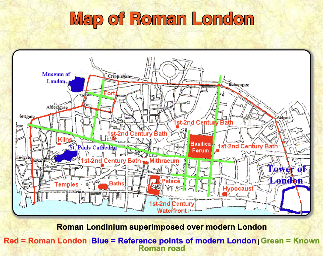 </figure>
图2. 罗马人的伦敦城遗迹位置示意。(图源:网络)
<figure>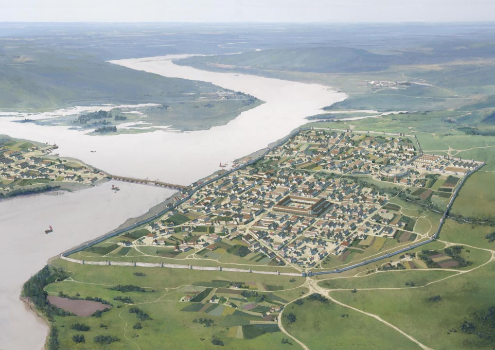 </figure>
图3. 罗马人的伦敦城复原图鸟瞰。(图源:网络)
<figure>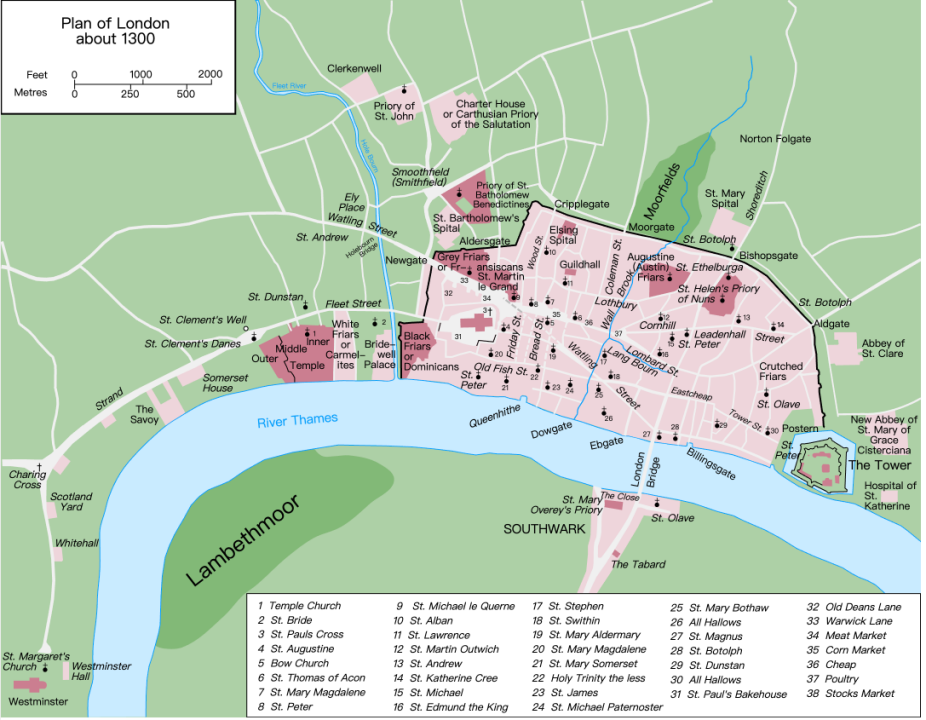 </figure>
图4. 公元1300年的伦敦城地图。(图源:网络)
<figure>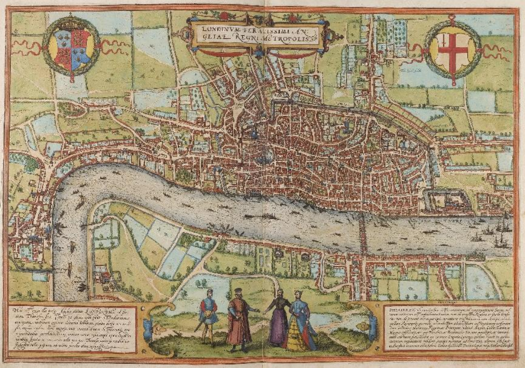 </figure>
图5. 16世纪的伦敦城,内部密布的建筑与各个行会组织有关。(图源:网络)
<figure>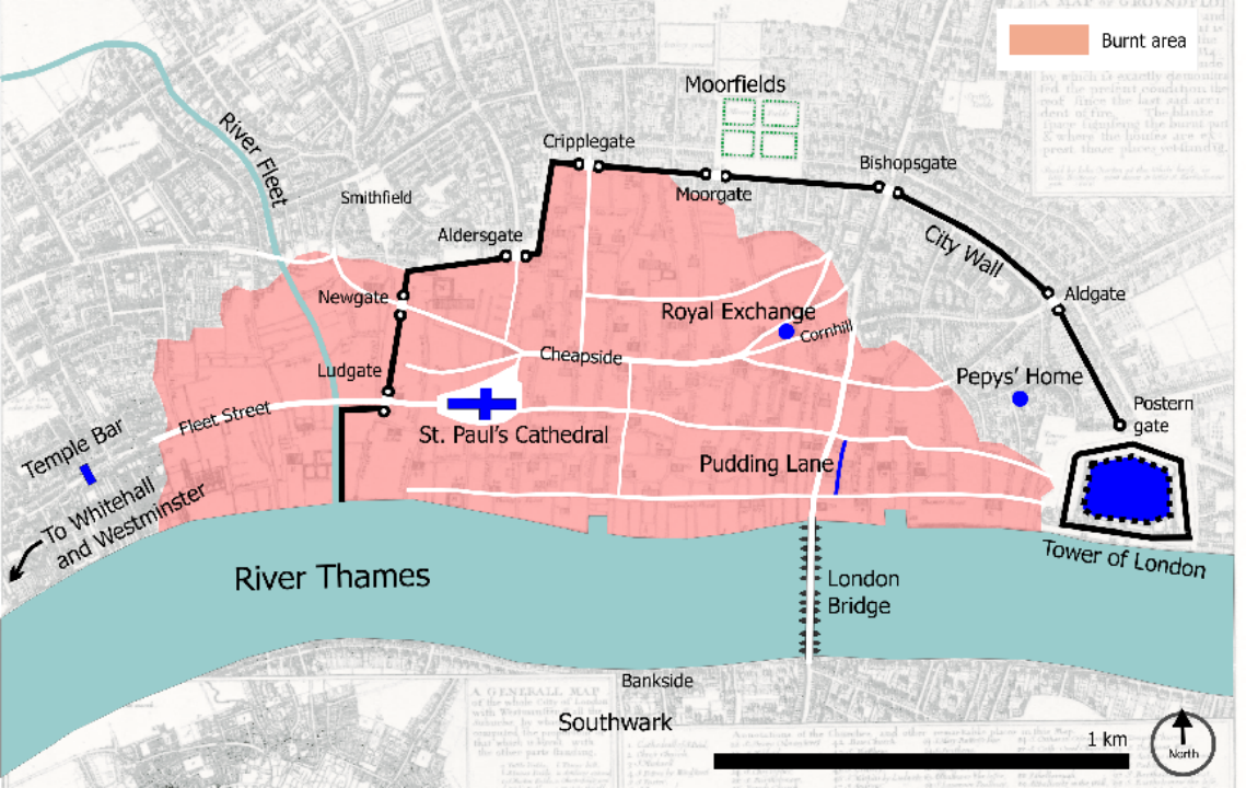 </figure>
图6. 1666年伦敦大火所烧毁的区域显示为粉色。(图源:网络)
<figure>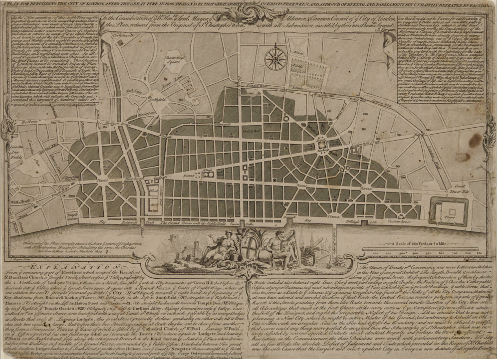 </figure>
图7. 伦敦大火后建筑师Christopher Wren提出的伦敦重建规划,重整了整体的路网,但因产权协商过于困难而无法实施。(图源:RIBA)
<figure>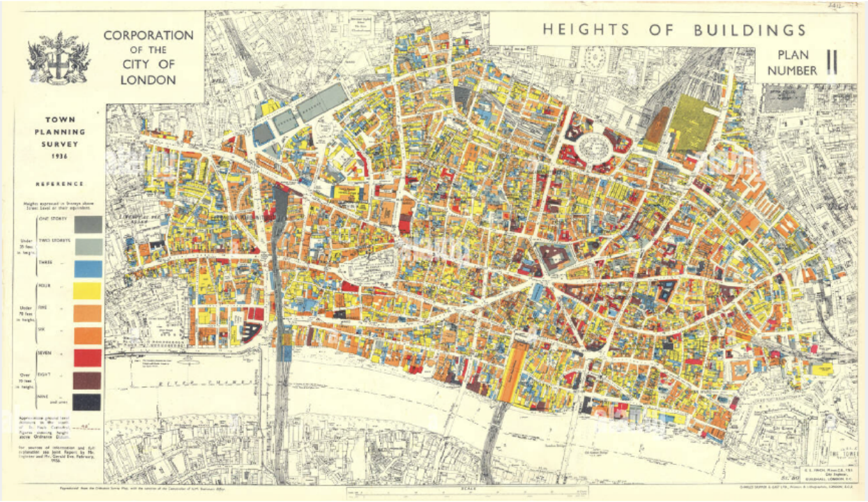 </figure>
图8. 1936年伦敦城建筑高度示意地图,黄色为四层建筑,占据了大部分面积。(图源:网络)
<figure>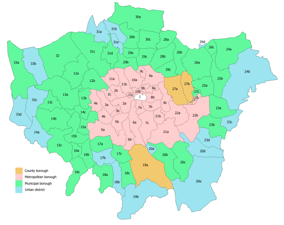 </figure>
图9. 今天的大伦敦范围,中间的1号区域是the City of London范围,其他编号为各个borough的范围。(图源:网络)
<figure>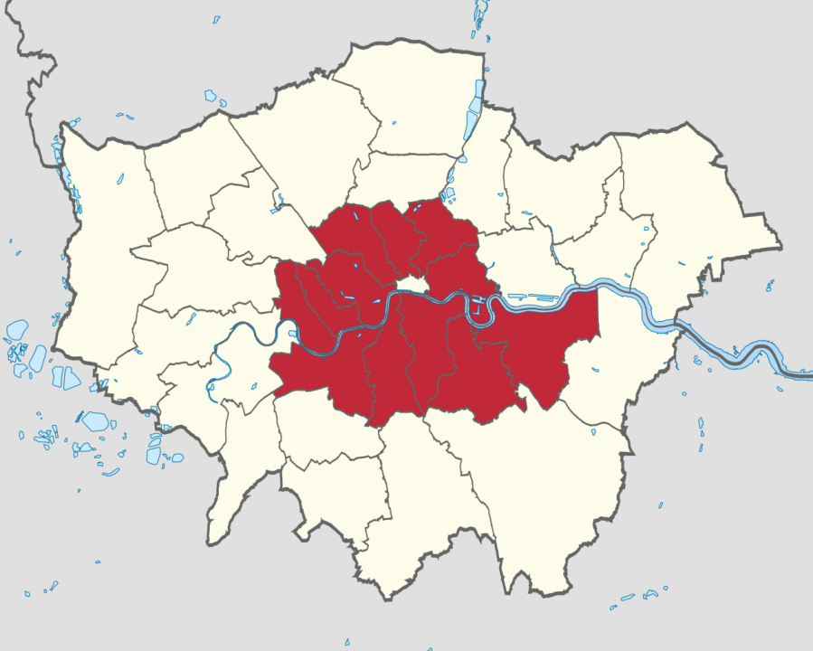 </figure>
图10. 中间的白色区域为the City of London, 红色区域为inner London, 而灰色的边界包含了整个the Greater London. (图源:网络)
<figure>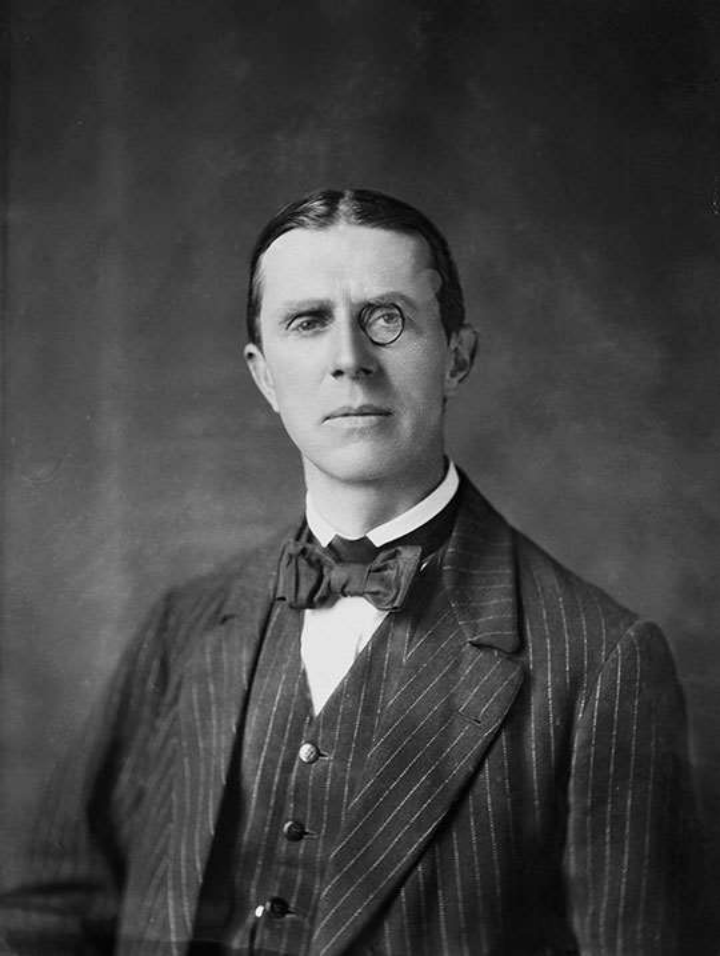 </figure>
图11. Patrick Abercrombie (图源:网络)
<figure>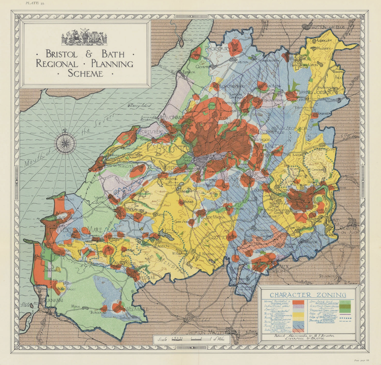 </figure>
图 12. Bristol and Bath Regional Planning. (图源:Patrick Abercrombie, Town and Country Planning, 1943)
<figure>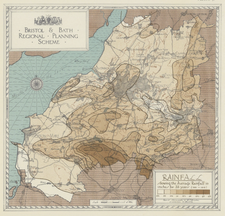 </figure>
图 13. Bristol and Bath Regional Planning. (图源:Patrick Abercrombie, Town and Country Planning, 1943)
<figure> </figure>
图 14. Bristol and Bath Regional Planning. (图源:Patrick Abercrombie, Town and Country Planning, 1943)
<figure>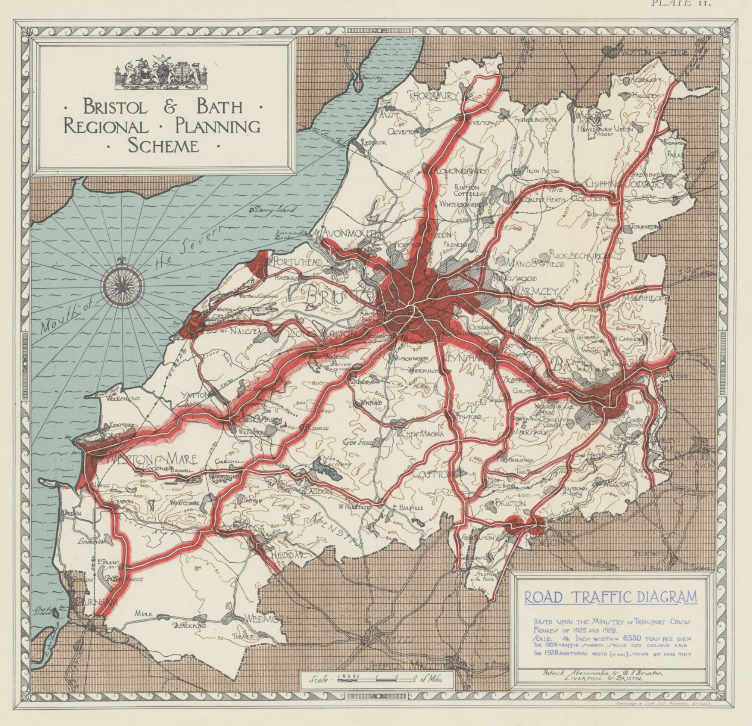 </figure>
图 15. Bristol and Bath Regional Planning. (图源:Patrick Abercrombie, Town and Country Planning, 1943)
<figure>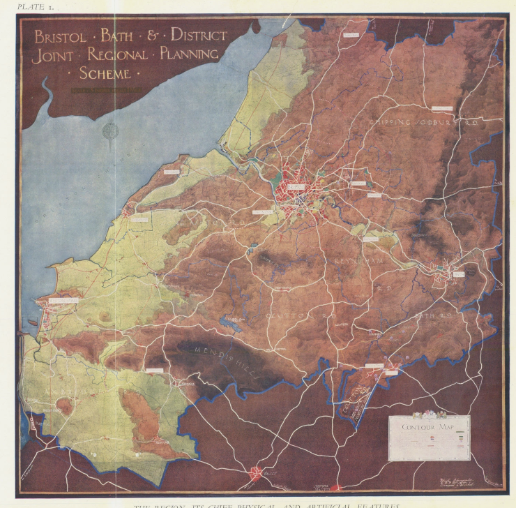 </figure>
图 16. Bristol and Bath Regional Planning. (图源:Patrick Abercrombie, Town and Country Planning, 1943)
<figure>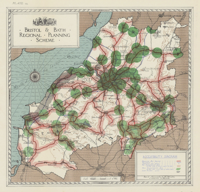 </figure>
图 17. Bristol and Bath Regional Planning. (图源:Patrick Abercrombie, Town and Country Planning, 1943)
<figure>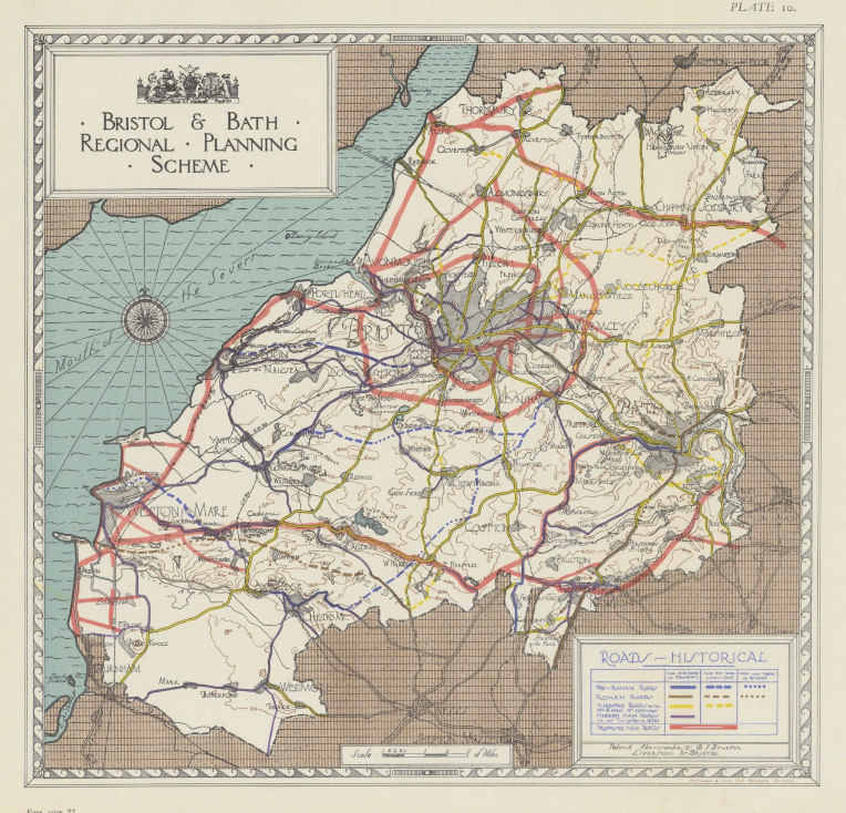 </figure>
图 18. Bristol and Bath Regional Planning. (图源:Patrick Abercrombie, Town and Country Planning, 1943)
<figure>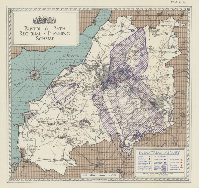 </figure>
图 19. Bristol and Bath Regional Planning. (图源:Patrick Abercrombie, Town and Country Planning, 1943)
<figure>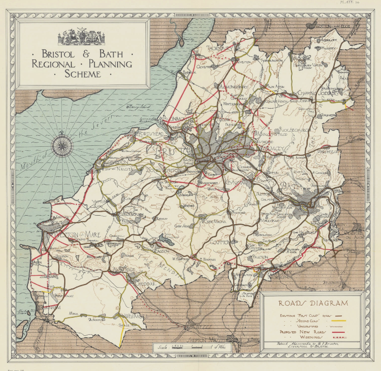 </figure>
图 20. Bristol and Bath Regional Planning. (图源:Patrick Abercrombie, Town and Country Planning, 1943)
<figure> </figure>
图 21. Bristol and Bath Regional Planning. (图源:Patrick Abercrombie, Town and Country Planning, 1943)
<figure>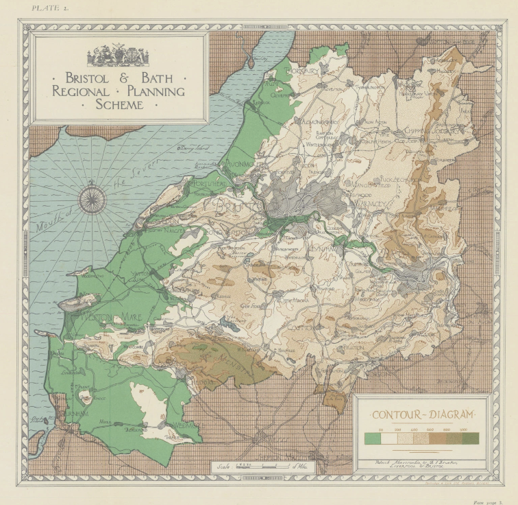 </figure>
图 22. Bristol and Bath Regional Planning. (图源:Patrick Abercrombie, Town and Country Planning, 1943)
<figure>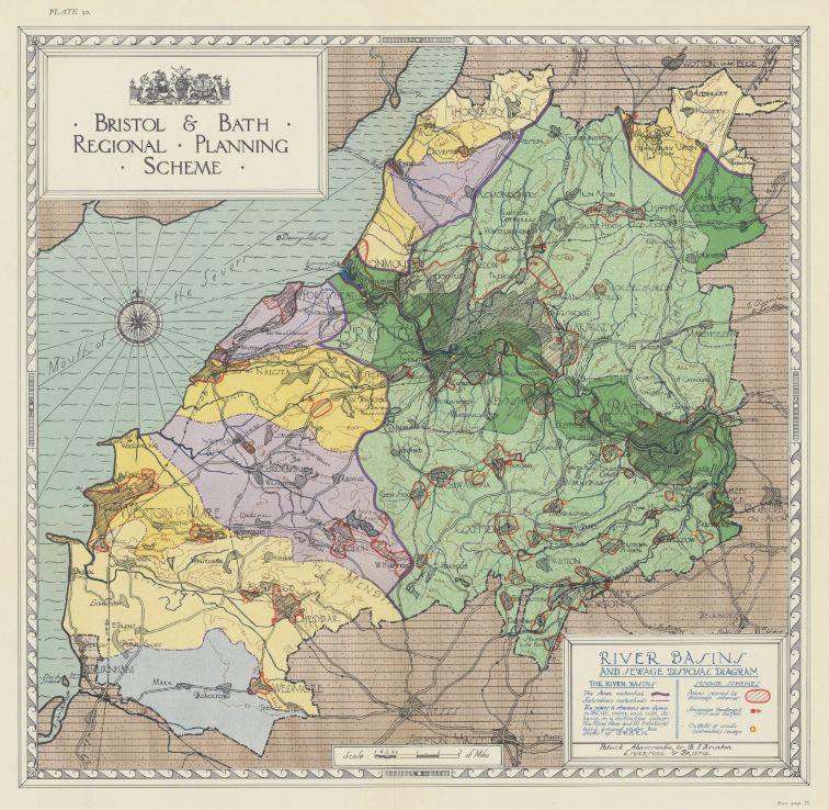 </figure>
图 23. Bristol and Bath Regional Planning. (图源:Patrick Abercrombie, Town and Country Planning, 1943)
<figure>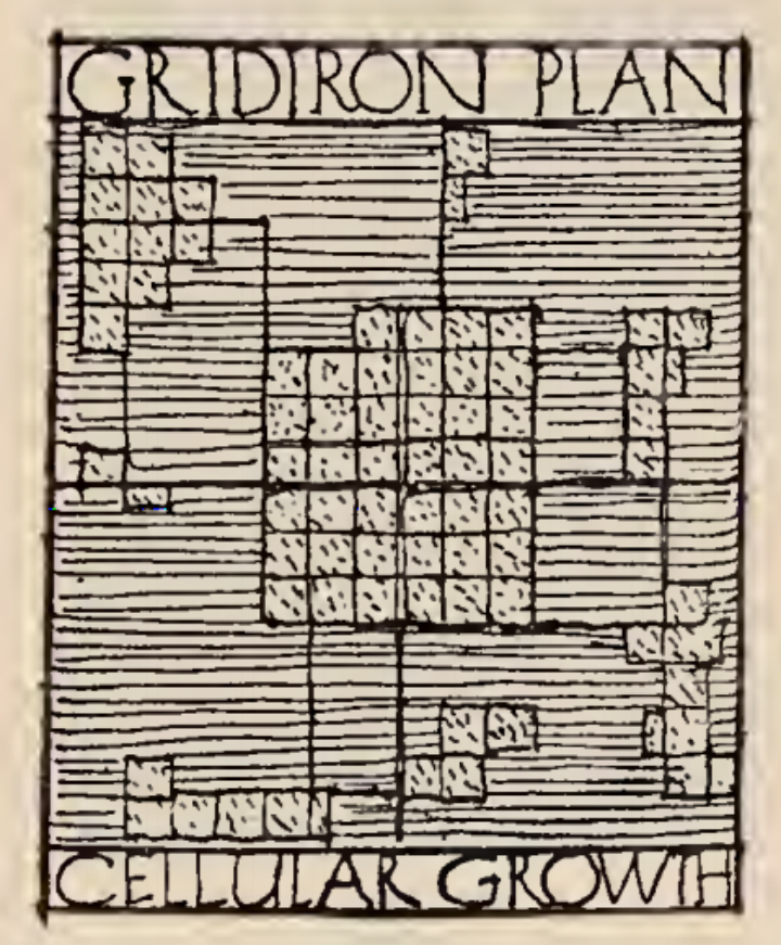 </figure>
图 24. Abercrombie所介绍的方形规划原型。(图源:Patrick Abercrombie, Town and Country Planning, 1943)
<figure>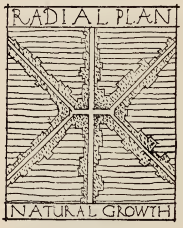 </figure>
图 25. Abercrombie所介绍的放射规划原型。(图源:Patrick Abercrombie, Town and Country Planning, 1943)
<figure>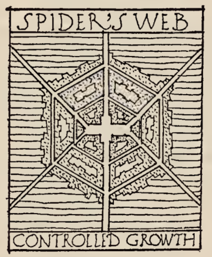 </figure>
图 26. Abercrombie所介绍的蜘蛛网规划原型。(图源:Patrick Abercrombie, Town and Country Planning, 1943)
<figure>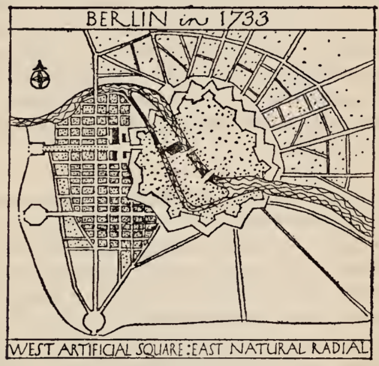 </figure>
图 27. 1733年柏林的城市布局符合Abercrombie所介绍的两种原型的组合。(图源:Patrick Abercrombie, Town and Country Planning, 1943)
<figure>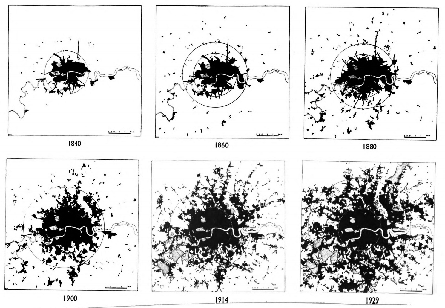 </figure>
图28. 伦敦城市扩张时序状态(Greater London Plan 1944)
<figure>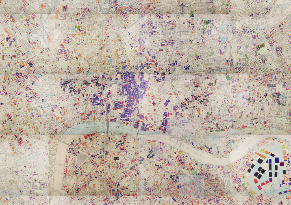 </figure>
图29. London County Council Bomb Damage Maps (London Picture Archives)
<figure>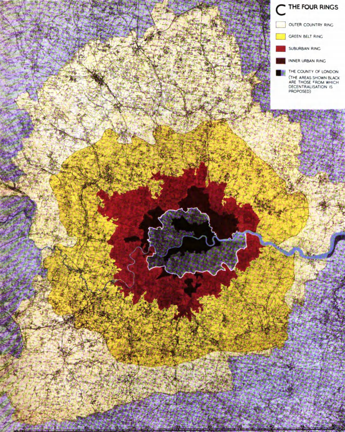 </figure>
图30. Abercrombie的大伦敦规划环状结构 (The Greater London Plan 1944)
<figure>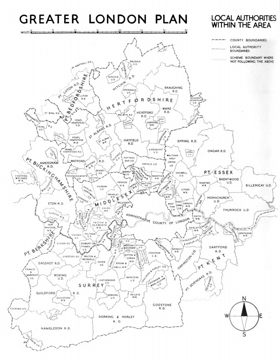 </figure>
图31. 大伦敦规划所包含的地方政府范围(The Greater London Plan 1944)
<figure>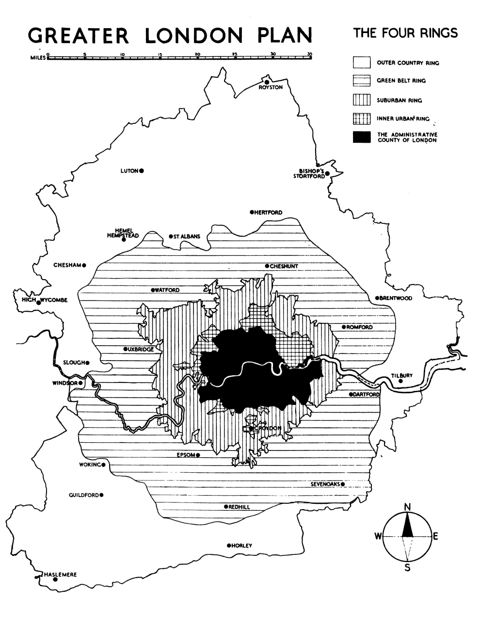 </figure>
图32. Abercrombie的大伦敦规划环状结构 (The Greater London Plan 1944)
<figure>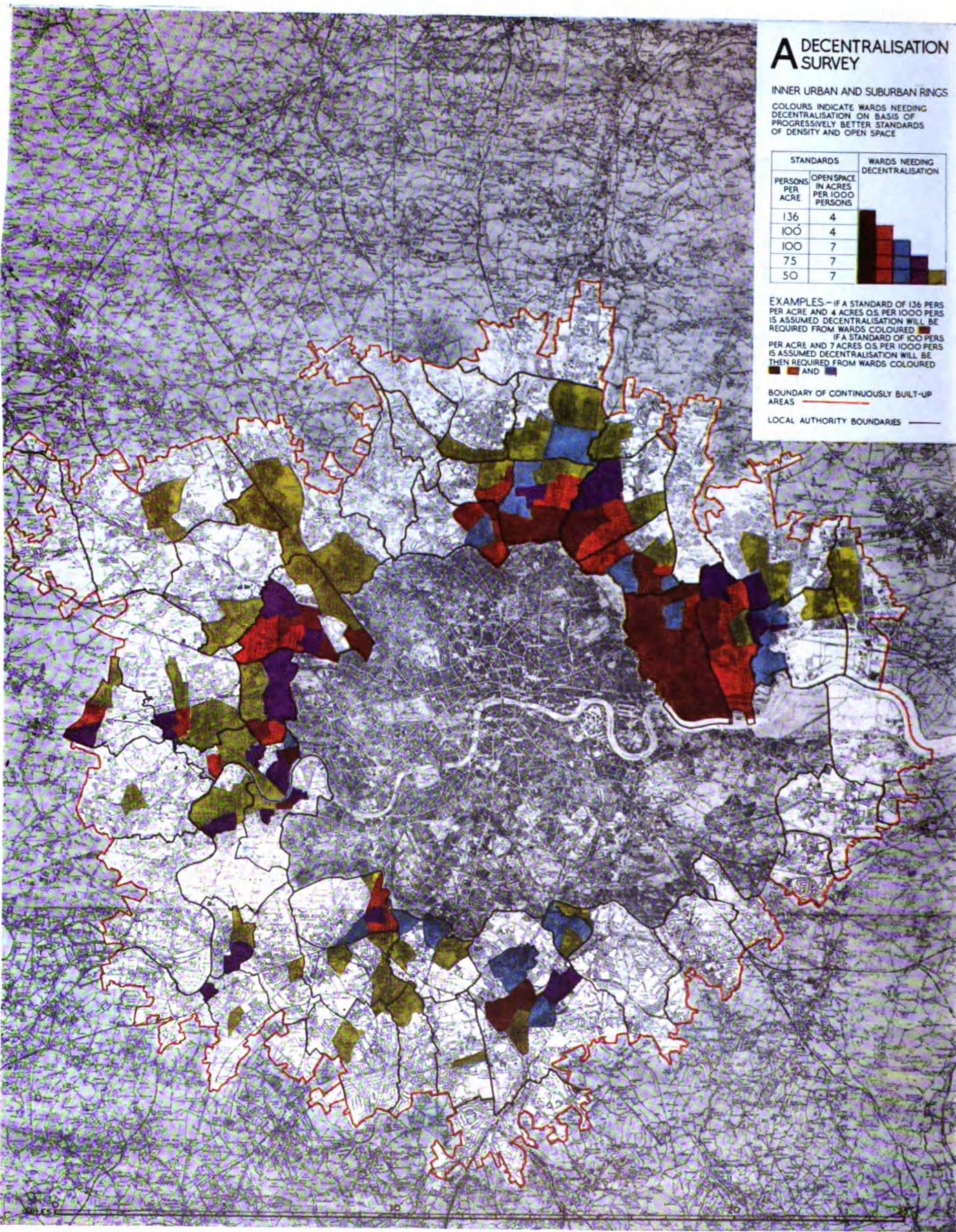 </figure>
图33. 疏散调查示意,哪些地方地块的工业需要被何种程度的疏散(The Greater London Plan 1944)
<figure>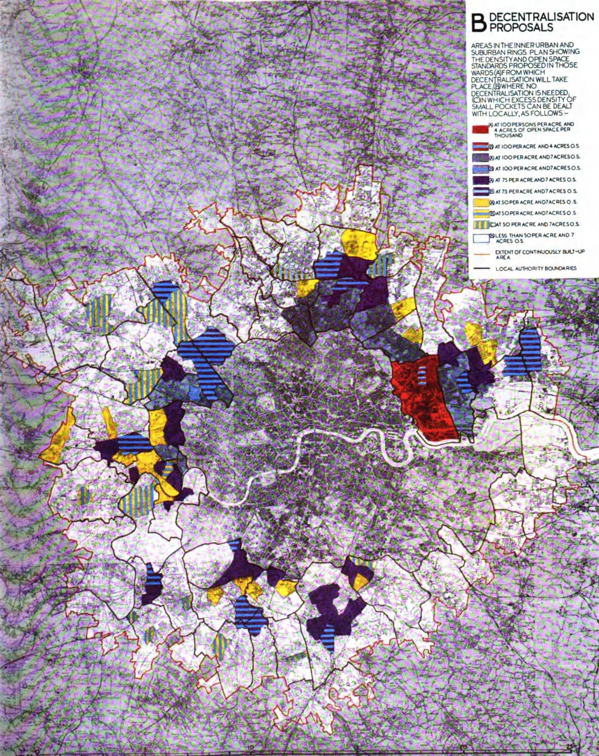 </figure>
图34. 疏散计划,以人口密度为逻辑(The Greater London Plan 1944)


:他在东方看见光")


 United States
