From Kauai to Your Town - How Data Can Help Cut Climate Threats
Description
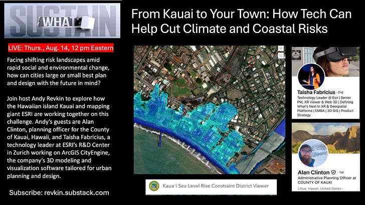
This is the podcast post for my Sustain What conversation eploring how cities, counties and perhaps your community can use data mapping and visualization tools to get ahead of climate risks as people and property increasingly sprawl into flood, fire, heat and storm danger zones - and as human-amped climate change intensifies some of those hazards.
Watch above and share this post, or do the same on LinkedIn, Facebook, X/Twitter or YouTube:
My guests were Alan Clinton, planning officer for the County of Kauai, Hawaii, and Taisha Fabricius, a technology leader at ESRI’s R&D Center in Zurich working to facilitate the capacity of risk managers, emergency preparedness personnel and planners to use “digital twins” of facilities or communities to identify and mitigate threats.
Clinton described a particularly interesting case study in Kauai in which data on coastal erosion isn’t just clarifying decisionmaking; it has been directly integrated into regulations governing seaside building.
We've been trying to find ways that we can really thread the needle on balancing community impacts and private property rights. And so the little viewer on the left actually indicates data that we integrated into something called a shoreline setback ordinance. And so this is another Esri application that we brought our data into.
And this is my favorite snapshot of this area because there is a small boat harbor smack dab in the middle of that beach. You can see just based off the coloring on the left, it is leading to a disruption of the movement of sand, of wave energy, and so those properties on the left are dramatically facing chronic erosion at a rate of about, I believe, that transect is 3.5 feet per year. And so that is substantial. And on the right of that, it's a growing beach that is gaining sand. And so we've been very mindful of trying to limit shoreline hardening because we realize these are dynamic natural ecosystems that require some fluctuations. Our shoreline setback ordinance was a really great stepping stone for how we integrate science and satellite imagery to evaluate the march of the beach inland or as it grows and bring it into a regulatory policy.
Taisha Fabricius from Esri took us on a tour of various applications of the company’s suite of urban and community planning platforms. Here’s a snippet of video showing how Zurich can anticipate flood impacts.
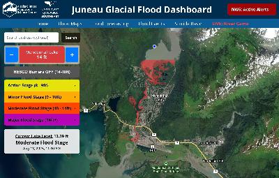
I noted how valuable such a tool would be in Juneau, Alaska, where glacial lake outburst floods have become a chronic threat, as I just explored the day before:
More resources
Geo Week News - How Kaua'i County uses GIS to future-proof development
Data Smart City Solutions (Harvard Kennedy School) - Future Tides: How Kaua'i Fights Sea Level Rise with Data
Thank you Lucy Gray, Sean Higgins, and many others for tuning into my live video! Join me for my next live video in the app.
Help sutain Sustain What if you can afford it. I hate paywalls.
This is a public episode. If you'd like to discuss this with other subscribers or get access to bonus episodes, visit revkin.substack.com/subscribe




![A Fresh Look at Climate [In]Justice (and Trump 2.0) with Cass Sunstein A Fresh Look at Climate [In]Justice (and Trump 2.0) with Cass Sunstein](https://substackcdn.com/feed/podcast/1136572/post/170360219/caefacbefd025361c8a8311a6b25f6a0.jpg)

