


Increasing clouds Monday with a wintry mix south into the night
Description
Cooler, more seasonable weather will persist this week. Minnesota will be grazed by a couple systems with the first bringing a wintry mix Monday night to southern Minnesota.
Increasing clouds Monday with rain, snow showers south Monday night
We’ll have bright skies to start, but clouds will be on the increase Monday ahead of a system that will be centered south of Minnesota. Afternoon highs will be in the 40s south to 30s north.
<figure class="figure figure-none figure-full"><source type="image/webp" /><source type="image/png" />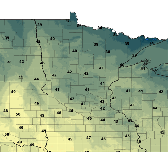 <figcaption class="figure_caption">
We’ll see rain showers reach southwestern Minnesota late Monday afternoon and mix with and turn to snow and a wintry mix overnight into early Tuesday morning.
<figure class="figure figure-none figure-full"><source type="image/gif" />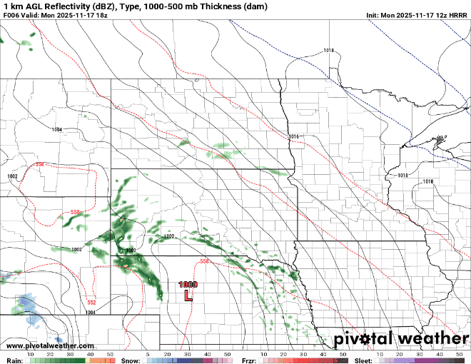 <figcaption class="figure_caption">
Overnight lows will be near freezing across southern Minnesota with teens north where skies will remain at least partially clear and dry.
<figure class="figure figure-none figure-full"><source type="image/webp" /><source type="image/png" />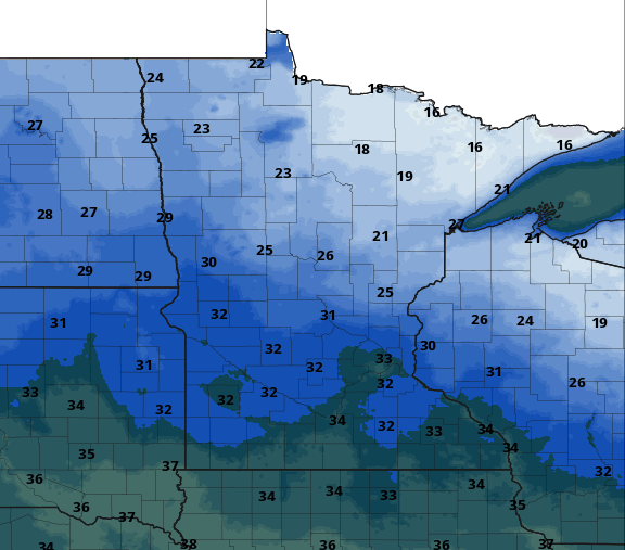 <figcaption class="figure_caption">
There will likely be some slushy accumulation across southern portions of Minnesota into Tuesday morning. The better chances for more than an inch will be southeastern Minnesota.
<figure class="figure figure-none figure-full"><source type="image/webp" /><source type="image/png" />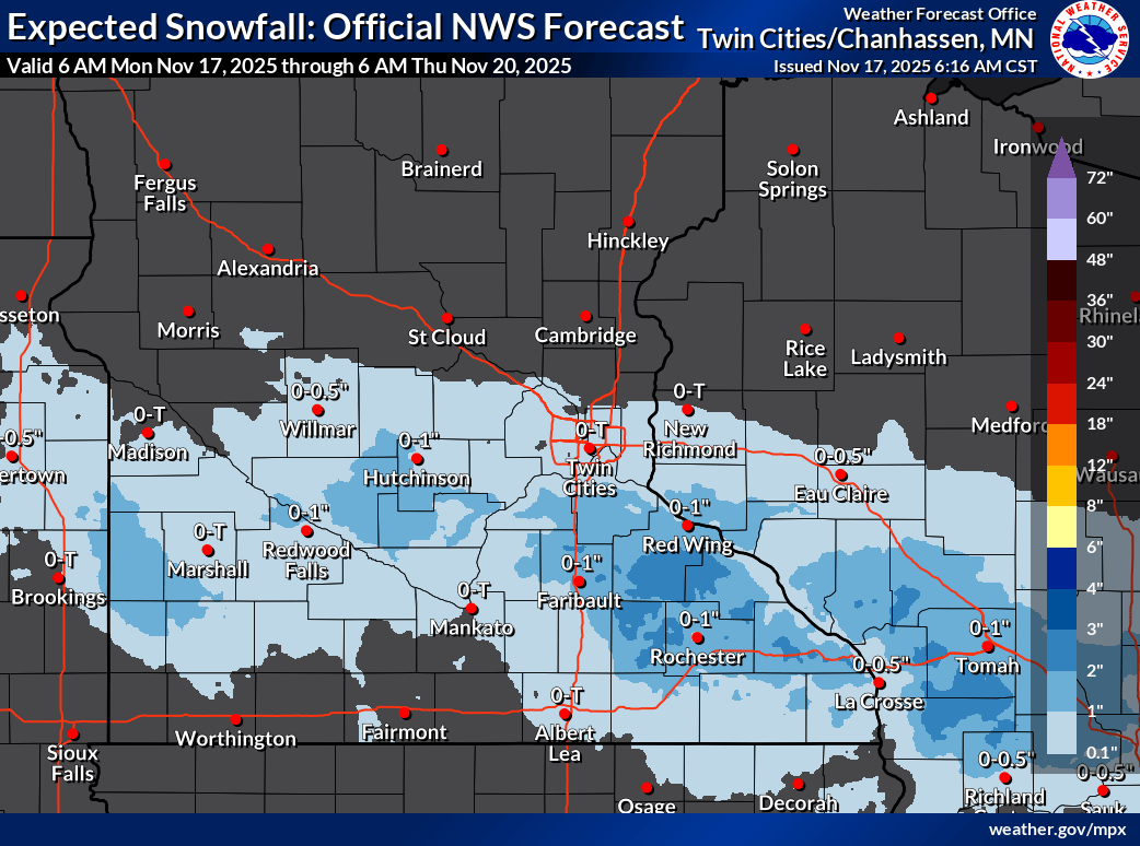 <figcaption class="figure_caption">
A few forecast models are hinting at higher amounts. Early season snowfalls are a tricky forecast with warm ground temperatures and a mix of rain and snow, but there is the possibility of more than 3 inches in some isolated pockets:
<figure class="figure figure-none figure-full"><source type="image/webp" /><source type="image/png" />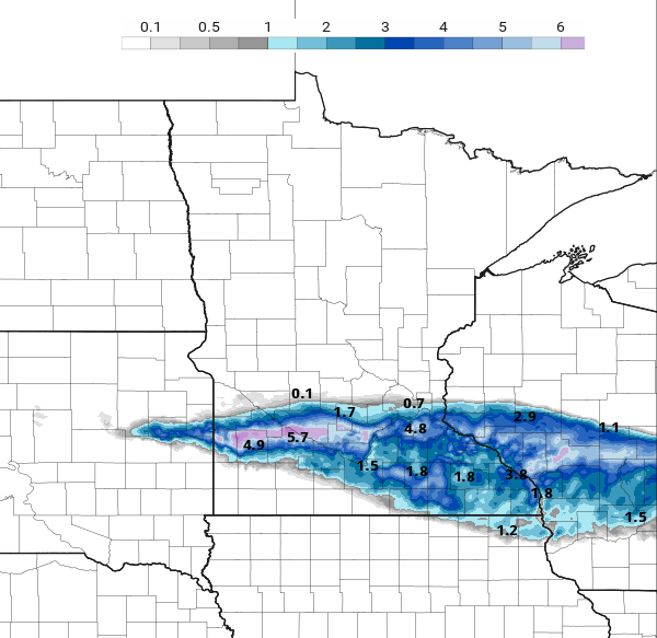 <figcaption class="figure_caption">
We’re keeping our eyes on another potential system late Wednesday into Thursday and Friday. Just like Monday night’s system, it will take a more southerly track with the more significant moisture.
Temperatures this week will be pretty seasonable in the 40s and 30s, even slightly above normal for the most part and without any big swings in temperatures.
Heading into next week, Thanksgiving week, we could be in for a significant pattern change.
Most forecast models and official forecasts from the National Oceanic and Atmospheric Administration’s Climate Prediction Center show a shift toward colder air and above normal precipitation.
We could be in for a colder and snowy shift in Minnesota sometime late next week or in the start of December.
<figure class="figure figure-none figure-full"><source type="image/webp" /><source type="image/png" />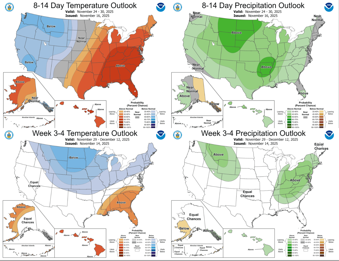 <figcaption class="figure_caption">


 United States
