


High pressure brings bright, breezy conditions with warmer temps ahead
Description
Look for sunshine with mild, breezy conditions Wednesday. Temperatures warm even more by the end of the week before a weekend cold front.
Mild, quiet the remainder of the week
We’ll have a bright day Wednesday with ample sunshine except portions of northeast Minnesota which will see some lingering clouds. Some high clouds will move through occasionally. Afternoon highs will be back in the 50s across southern Minnesota with 40s north.
<figure class="figure figure-none figure-full"><source type="image/webp" /><source type="image/png" />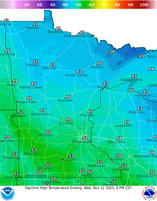 <figcaption class="figure_caption">
It’ll be a breezy day with northwest winds at 10-20 mph but winds should lighten up heading into Thursday.
<figure class="figure figure-none figure-full"><source type="image/gif" />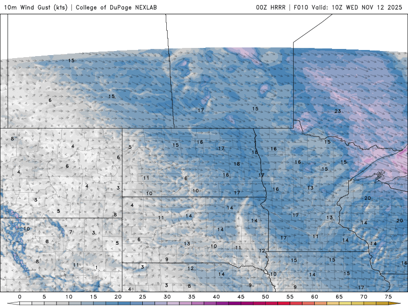 <figcaption class="figure_caption">
Thursday will be more of the same with highs back in the 50s and 40s and more sunshine. Friday and Saturday look to be warmer however. Highs Friday will warm into the 60s across southern Minnesota. Those temps are nearly 15 to 20 degrees above normal.
<figure class="figure figure-none figure-full"><source type="image/webp" /><source type="image/png" />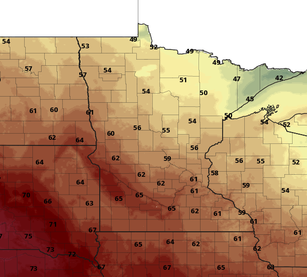 <figcaption class="figure_caption">
Saturday will be near 60-degrees once again but with increased cloud cover as a cold front moves in late, touching off a few showers and dropping temperatures for Sunday. Most of early next week looks to be seasonable with highs in the low to mid 40s.


 United States
