


Warm and windy Monday; busy weather pattern ahead
Description
It’s a warm and windy start to the week, and those gusty winds are combining with low humidity to create elevated fire weather conditions Monday afternoon.
A busy weather pattern is on the way, with multiple waves moving through the region this week, though precipitation looks limited for most areas.
Elevated fire weather concerns
Our passing cold front from Sunday night has really dried things out for Monday with dew points dropping into the 20s and even the teens across the northern part of the state.
<figure class="figure figure-none figure-full"><source type="image/gif" />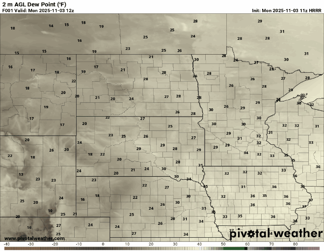 <figcaption class="figure_caption">
When you combine the dry air with those gusty westerly winds, you get a recipe for elevated fire weather conditions. The northern two-thirds of the state will be most at risk with an increased potential for rapid fire spread Monday afternoon.
Westerly winds will generally be around 10 to 15 mph, with gusts reaching 25 to 30 mph into Monday afternoon, before easing around sunset.
<figure class="figure figure-none figure-full"><source type="image/gif" />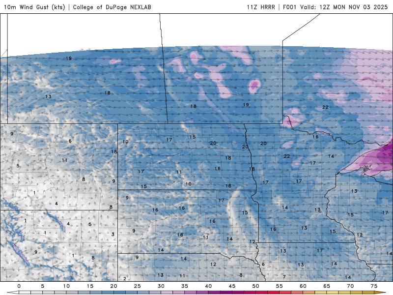 <figcaption class="figure_caption">
A mild week of temperatures is in store for the state. On Monday, highs will warm into the upper 40s to low 50s across northern and central Minnesota, reach the mid-50s around the Twin Cities metro, and even some 60-degree readings may pop up in southwestern Minnesota.
<figure class="figure figure-none figure-full"><source type="image/webp" /><source type="image/png" />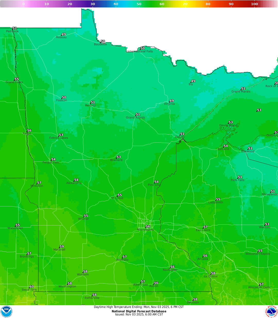 <figcaption class="figure_caption">
Our jet stream is positioned to the north in Canada, keeping cooler temperatures bottled up well to our north. As a result, these mild, above-average readings are expected to persist through Thursday.
<figure class="figure figure-none figure-full"><source type="image/webp" /><source type="image/png" />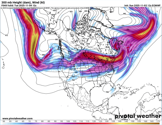 <figcaption class="figure_caption">
Clipper train this week
Our clipper train will bring active but mostly dry weather to the region this week. Clippers are expected to move through Tuesday afternoon, Thursday afternoon, and another one over the weekend.
Forecast models are showing mostly dry conditions this week, with the exception of northern Minnesota, which could see some light precipitation with Tuesday’s system.
<figure class="figure figure-none figure-full"><source type="image/gif" />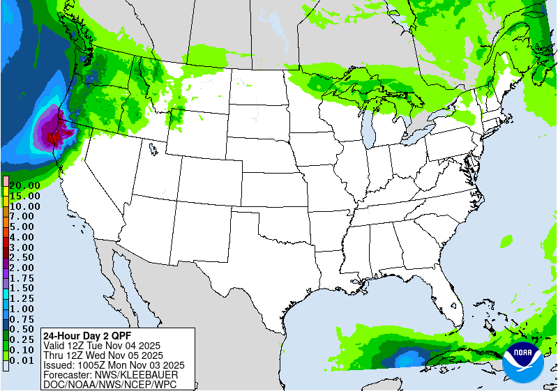 <figcaption class="figure_caption">
The clipper system moving through next weekend will bring some cooler air into the region, along with the possibility of a few snowflakes. It’s still too far out to provide many details, but models do suggest a brief cooldown for the weekend.
<figure class="figure figure-none figure-full"><source type="image/webp" /><source type="image/png" />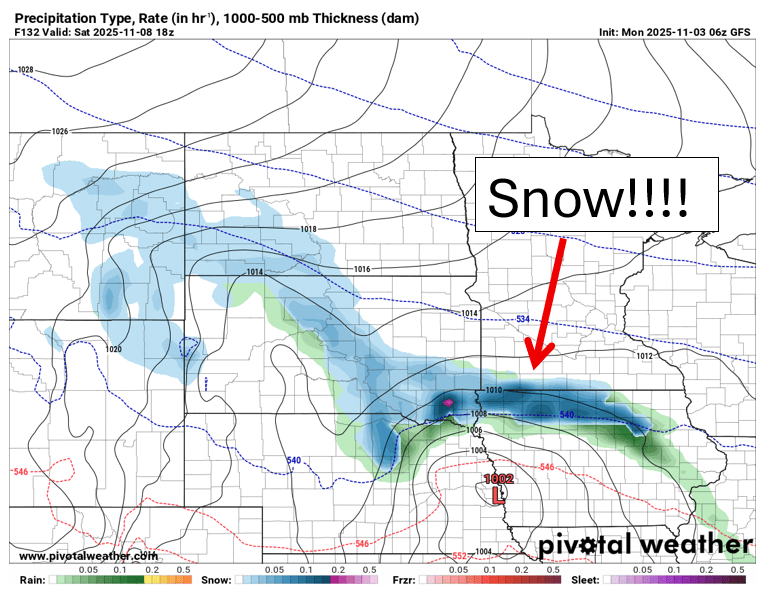 <figcaption class="figure_caption">


 United States
