


Areas of rain Tuesday with decreasing clouds Wednesday
Description
We’ll have on-and-off scattered rain showers Tuesday for much of Minnesota with a sharp gradient in the rainfall across eastern Minnesota. Clouds decrease Wednesday.
Areas of rainfall Tuesday with decreasing clouds Wednesday
It’ll be a wet day for a good portion of the state Tuesday as our latest disturbance brings on-and-off scattered of rain showers across the central portion of the state.
There will be a sharp cutoff from west to east in rainfall in eastern Minnesota and western Wisconsin into the Arrowhead region.
This system is sandwiched between two dry areas of high pressure, making for a narrow south to north band of rain showers as the whole system dives straight south, leaving areas to the east mostly dry.
<figure class="figure figure-none figure-full"><source type="image/gif" /> <figcaption class="figure_caption">
From south to north in the central part of the state, we could see one-half to 1 inch of needed rainfall. The Arrowhead, western Wisconsin and the east Twin Cities metro area will see significantly less, if anything.
<figure class="figure figure-none figure-full"><source type="image/webp" /><source type="image/png" />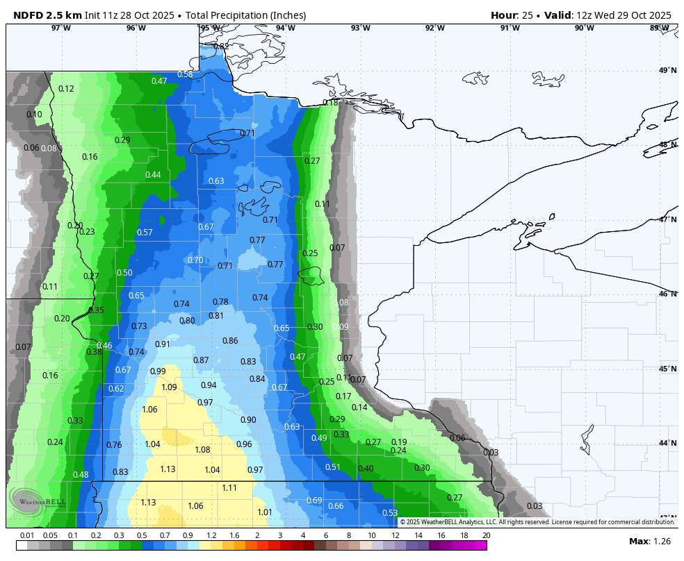 <figcaption class="figure_caption">
Temperatures will be cool, mostly in the 40s, where the rainfall will be consistent and steady. Southeastern Minnesota will squeeze out highs in the low to mid-50s.
<figure class="figure figure-none figure-full"><source type="image/webp" /><source type="image/png" />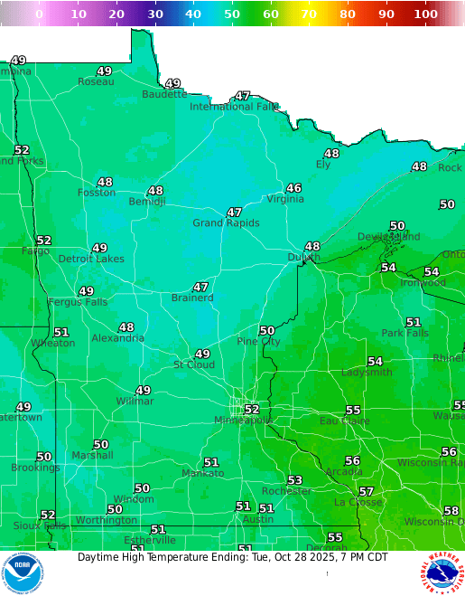 <figcaption class="figure_caption">
We should see decreasing clouds Wednesday, allowing for temperatures to warm up a bit more by Wednesday afternoon, mostly in the low to mid-50s.
<figure class="figure figure-none figure-full"><source type="image/webp" /><source type="image/png" />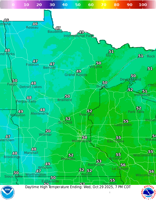 <figcaption class="figure_caption">
The remainder of the week looks relatively quiet with seasonable temperatures. Halloween Friday will be near-normal with highs in the upper 40s and a mix of clouds and sun. There could be one or two sprinkles around. Evening temps will remain in the 40s.
<figure class="figure figure-none figure-full"><source type="image/webp" /><source type="image/png" />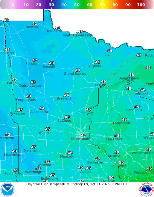 <figcaption class="figure_caption">
A pair of clipper systems will increase cloud cover this weekend and create the chance of a few rain showers. The Arrowhead may even see some snow mix with rain Sunday into Monday.


 United States
