


Warm-up on the way with increased sunshine
Description
By the end of the weekend, sunshine returns and warmer temperatures take hold for the week ahead. An active pattern will still bring a few light rain showers to the region, but most areas will stay dry.
Quiet night ahead
Scattered cloud cover is expected Saturday night as temperatures fall into the upper 20s to mid-30s.
<figure class="figure figure-none figure-full"><source type="image/webp" /><source type="image/png" />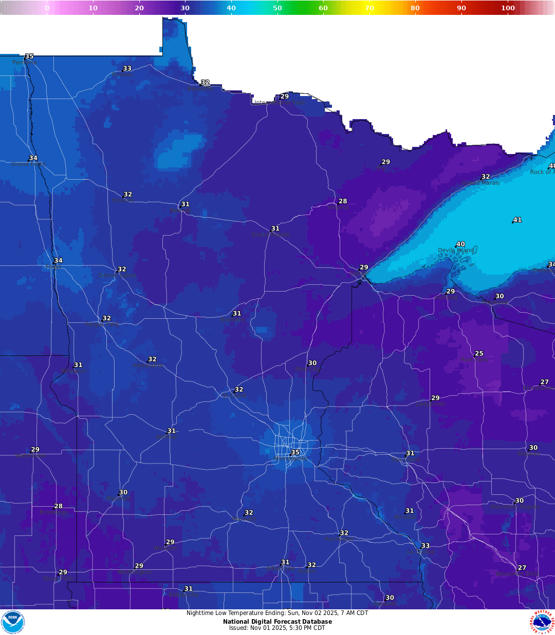 <figcaption class="figure_caption">
No precipitation is expected for most of Sunday as warmer temperatures take hold. Highs will climb into the upper 40s to low 50s under partly to mostly sunny skies.
<figure class="figure figure-none figure-full"><source type="image/webp" /><source type="image/png" /> <figcaption class="figure_caption">
The upcoming week features several weak disturbances moving through the region. Each system carries a small chance for light rain showers or sprinkles, but rainfall amounts will remain well below what’s needed to make a dent in the ongoing drought.
<figure class="figure figure-none figure-full"><source type="image/webp" /><source type="image/png" />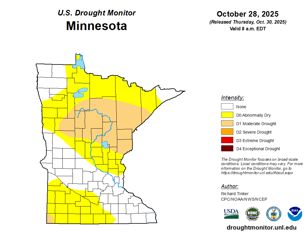 <figcaption class="figure_caption">
The clipper systems will bring increased cloud cover and periodic rain chances Sunday night, Wednesday, and again next weekend.
Early November temperatures will be on the mild side, with highs reaching the 50s and even into the 60s in parts of the state.


 United States
