


Mild Thursday, sunshine Friday; weekend looks bright
Description
Look for a mix of clouds and sun Thursday. It will be mild with highs near 50 in southern Minnesota. High pressure brings sunshine Friday with a mild weekend ahead.
Lingering clouds Thursday but sunshine returns Friday
We’ll see a lot of clouds still Thursday. Drier air moving in behind a weak cool front should give us some afternoon peeks of sun in southern Minnesota Thursday with cloudier skies north. The clouds break as high pressure settles in for Friday and the weekend.
<figure class="figure figure-none figure-full"><source type="image/gif" />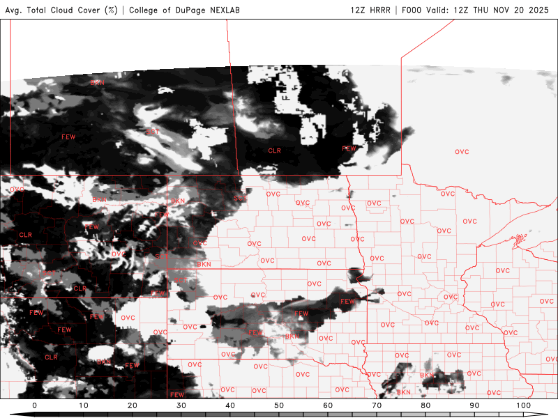 <figcaption class="figure_caption">
Afternoon highs will be rather mild despite the lack of sunshine, ranging from near 50 south to the upper 30s far north Thursday. Those readings are 5 to 15 degrees above normal.
<figure class="figure figure-none figure-full"><source type="image/webp" /><source type="image/png" />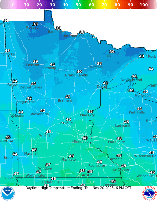 <figcaption class="figure_caption">
Winds will be switching from the south to the northwest, bringing in slightly cooler air Thursday night and Friday. Overnight lows will drop back below freezing for most after a string of milder nights recently.
<figure class="figure figure-none figure-full"><source type="image/webp" /><source type="image/png" />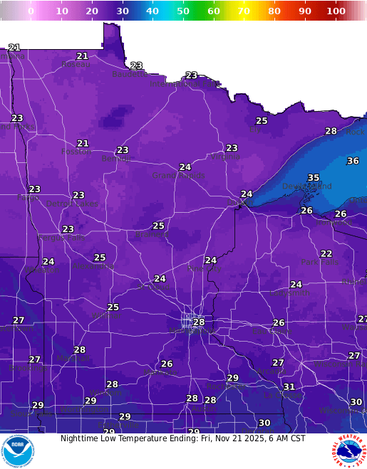 <figcaption class="figure_caption">
Friday will see quite a bit of sunshine with highs mostly in the 40s and 30s, a bit cooler than Thursday’s highs by just a few degrees.
<figure class="figure figure-none figure-full"><source type="image/webp" /><source type="image/png" />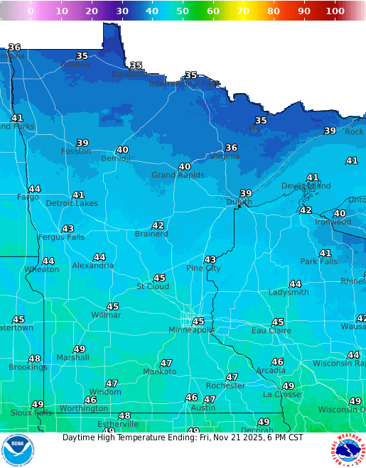 <figcaption class="figure_caption">
The weekend will be bright and mild. Look for more sun Saturday and Sunday, something that isn’t terribly common in late November. Highs will be in the 50s across southern Minnesota with 40s north, nearly 15 to 20 degrees above normal for some.
<figure class="figure figure-none figure-full"><source type="image/webp" /><source type="image/png" />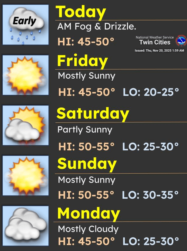 <figcaption class="figure_caption">
Colder air is still on track to reach Minnesota mid to late next week as the pattern shifts. The upper-level ridge of warmth will track east as the upper flow becomes colder from the north next week, pulling in our coldest air mass yet.
<figure class="figure figure-none figure-full"><source type="image/gif" />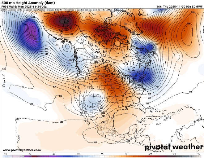 <figcaption class="figure_caption">
Look for a cold Thanksgiving into next weekend. Highs will be subfreezing statewide Thursday with our coldest readings yet Thursday night into early Friday morning. Lows early next Friday will be in the single digits and teens.
<figure class="figure figure-none figure-full"><source type="image/webp" /><source type="image/png" />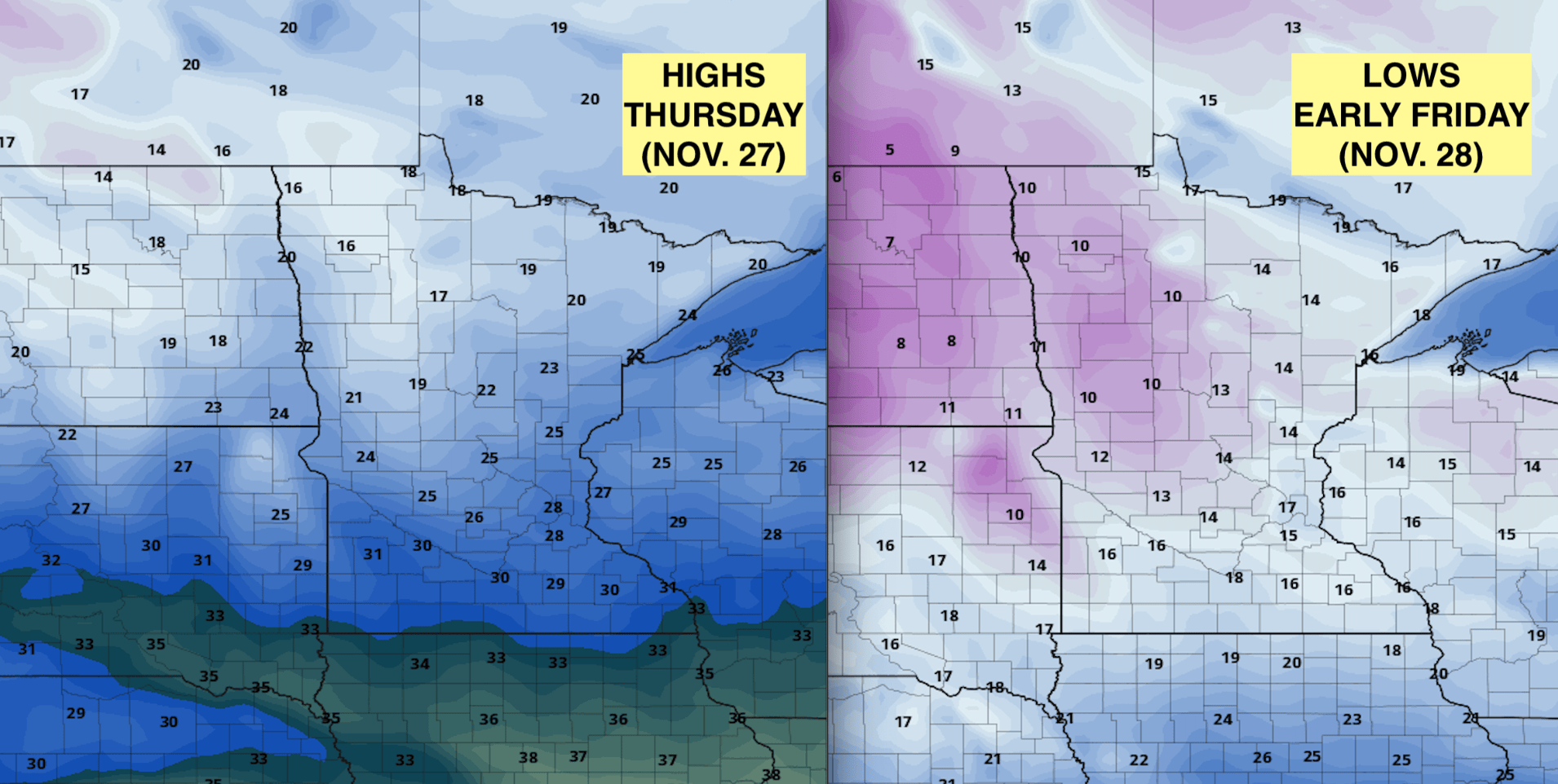 <figcaption class="figure_caption">


 United States
