


Mild temperatures to end the weekend followed by an active weather pattern
Description
Mild temperatures will close out the weekend, but a more active weather pattern is expected to develop early in the week.
Calm night followed by sunny Sunday
Clear skies and calm, northwesterly winds will bring cooler temperatures Saturday night, with lows in the 20s across the north and low 30s in the south.
<figure class="figure figure-none figure-full"><source type="image/webp" /><source type="image/png" />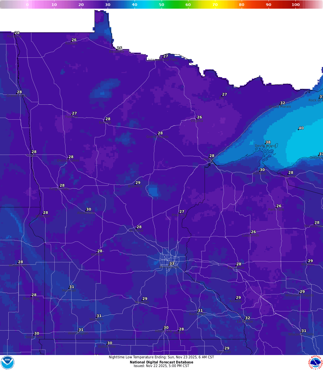 <figcaption class="figure_caption">
Sunday may be one of the last days this season to reach the 50s, with temperatures warming into the 40s in the north and 50s in the south, and some lower 60s possible in southwestern Minnesota.
<figure class="figure figure-none figure-full"><source type="image/webp" /><source type="image/png" />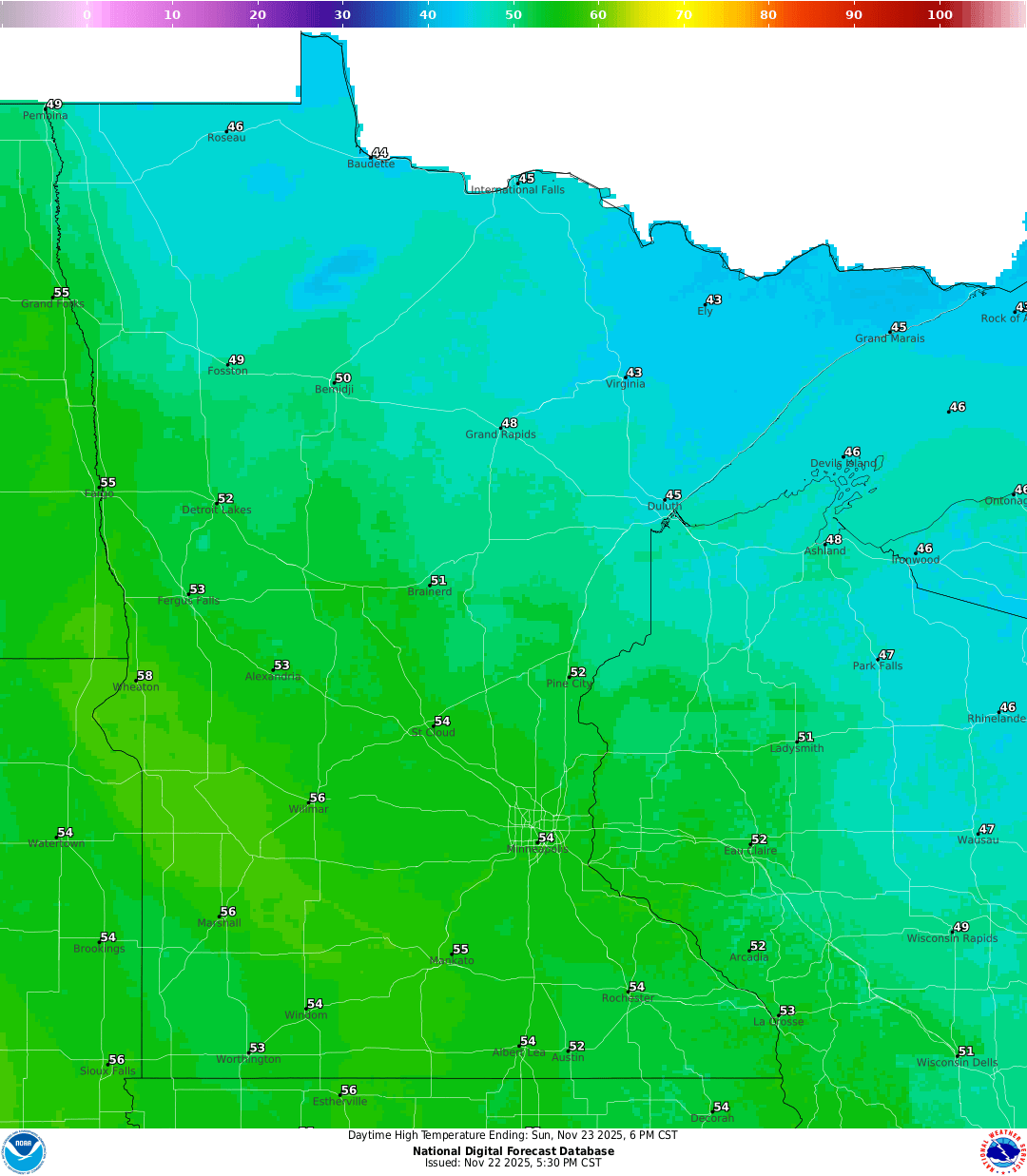 <figcaption class="figure_caption">
Monday will be one of the last mild days before a major cooldown arrives for Thanksgiving. A strong cold front will drop high temperatures into the 20s, with lows falling into the teens. Blustery winds will make it feel even colder, producing very chilly wind chills.
<figure class="figure figure-none figure-full"><source type="image/gif" />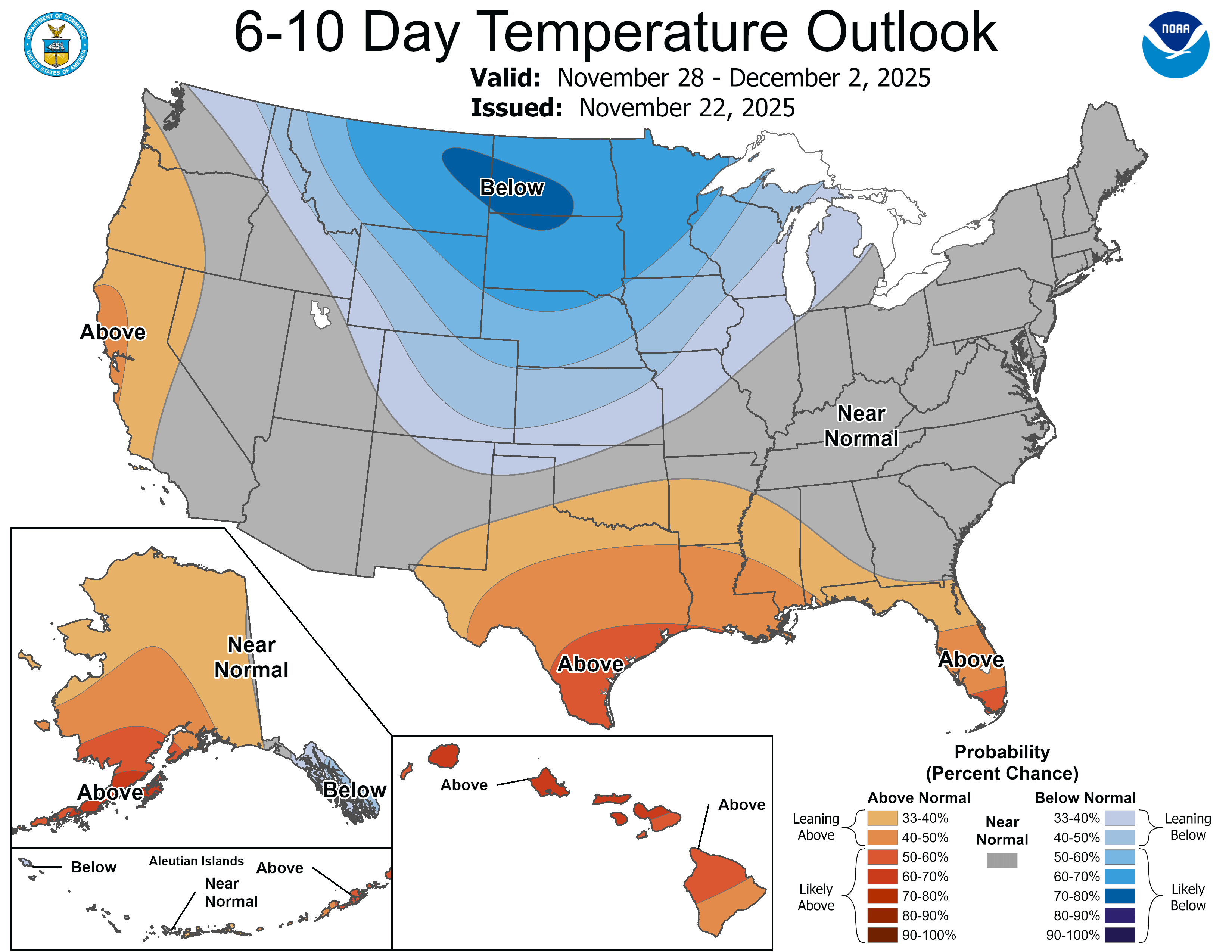 <figcaption class="figure_caption">
Much needed rainfall in the forecast
The start of the workweek will bring some much-needed rainfall to the region before the ground freezes for the season. Warmer temperatures will keep precipitation mainly as rain through Monday. Cooler air arrives Tuesday, changing the system over to snow that may linger into Wednesday morning.
The greatest chance for accumulating snowfall will be across central and especially northern Minnesota. More details on expected snowfall amounts will be available as the system gets closer.
<figure class="figure figure-none figure-full"><source type="image/gif" />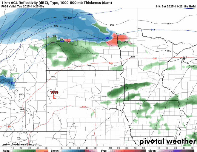 <figcaption class="figure_caption">
We’re still tracking the potential for a holiday weekend storm that could bring accumulating snowfall to the Upper Midwest from late November into early December. It’s too early to narrow down the details, but we can say with certainty that Thanksgiving will be chilly and blustery ahead of the system.


 United States
