


Rain gives way to snow as temperatures plunge
Description
Record-breaking warmth on Sunday will kick off a week of dramatic weather swings. By Thanksgiving, temperatures will plunge below freezing, with snow and blustery winds in the mix ahead of the deep cold.
From record breaking to a Thanksgiving freeze
Fall’s final performance delivered record highs for both St. Cloud and the Twin Cities, where the preliminary temperature reached 56 under sunny skies. This week will tell a much different weather story, with winterlike temperatures pushing into the region by the holiday and accumulating snow expected in the Northland.
Low temperatures will remain mild Sunday night, with readings in the upper 20s to low 30s. Areas of dense fog are possible for southern Minnesota into Monday morning.
<figure class="figure figure-none figure-full"><source type="image/webp" /><source type="image/png" />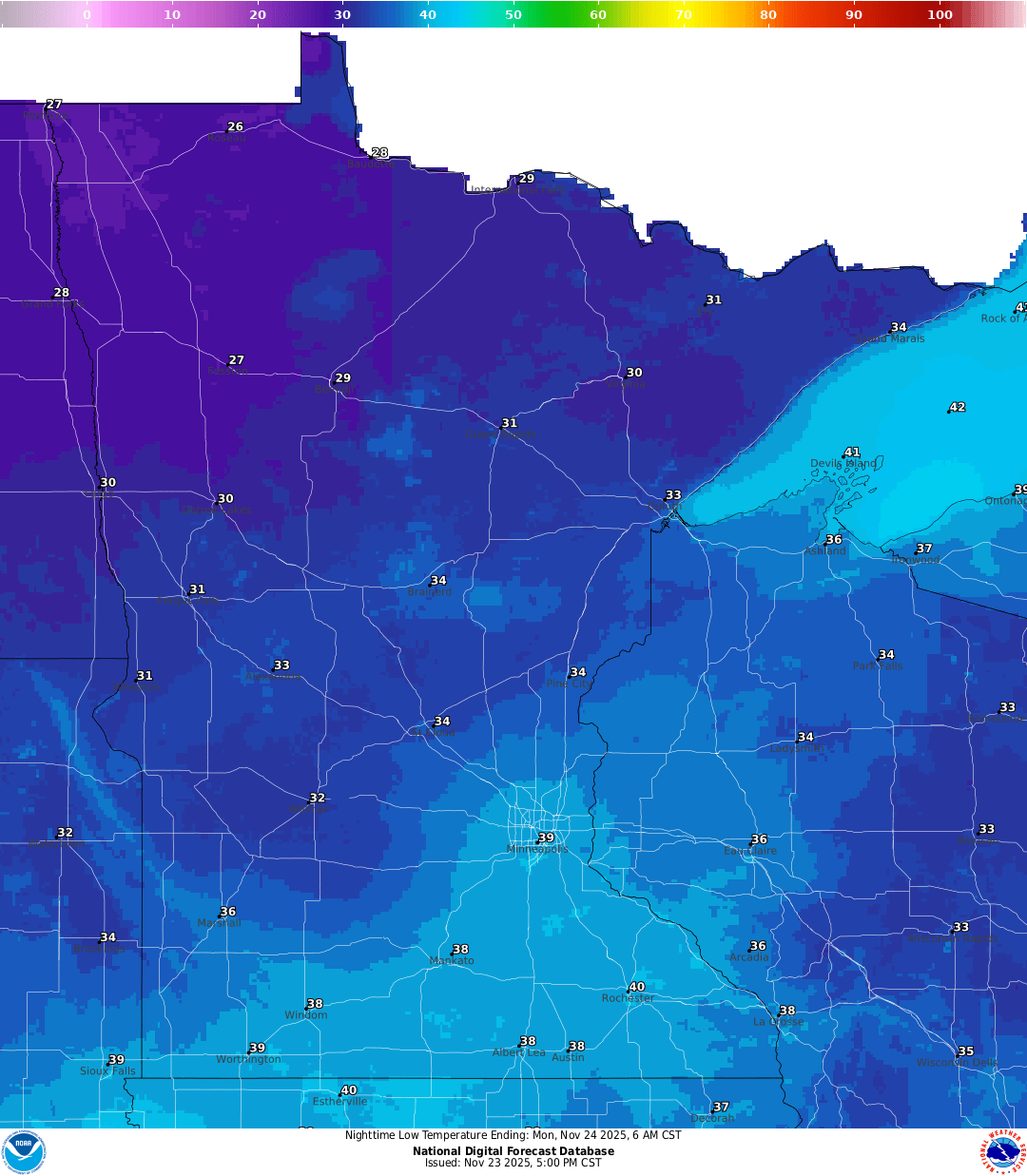 <figcaption class="figure_caption">
Temperatures will remain above average into Monday, with highs in the 40s across the north and lingering in the 50s in the south.
<figure class="figure figure-none figure-full"><source type="image/webp" /><source type="image/png" />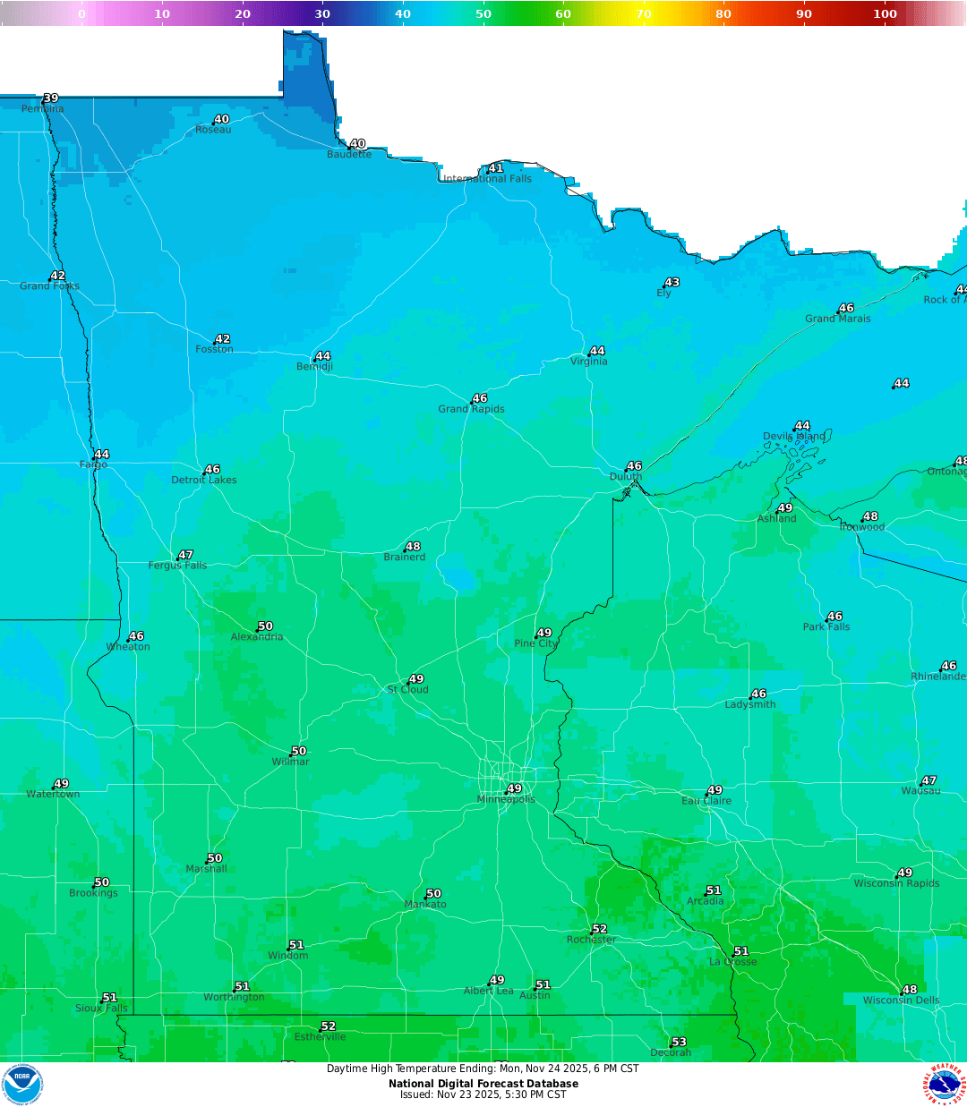 <figcaption class="figure_caption">
These warmer temperatures will bring rain showers Monday as a system moves out of the Four Corners region. Light rain will spread across the southern portions of the state into western Wisconsin.
Another stronger disturbance will deepen and draw in a much cooler Canadian air mass that will bring some frigid temperatures lasting through the holiday weekend. This system will produce accumulating snowfall mainly for areas north of Interstate 94.
<figure class="figure figure-none figure-full"><source type="image/gif" />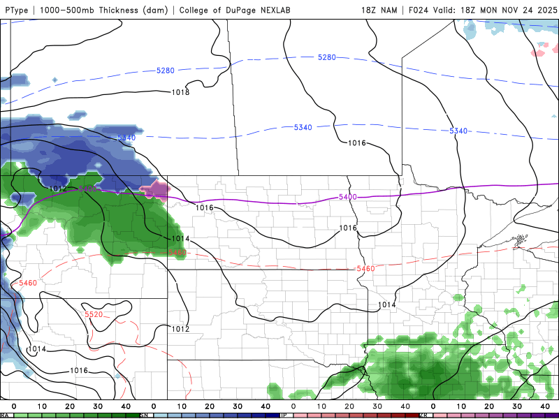 <figcaption class="figure_caption">
A winter storm watch has been issued for the northern third of the state from Tuesday morning through Wednesday morning, with the potential for 3 to 7 inches of snow. Snow may be heavy at times Tuesday night through early Wednesday.
<figure class="figure figure-none figure-full"><source type="image/webp" /><source type="image/png" />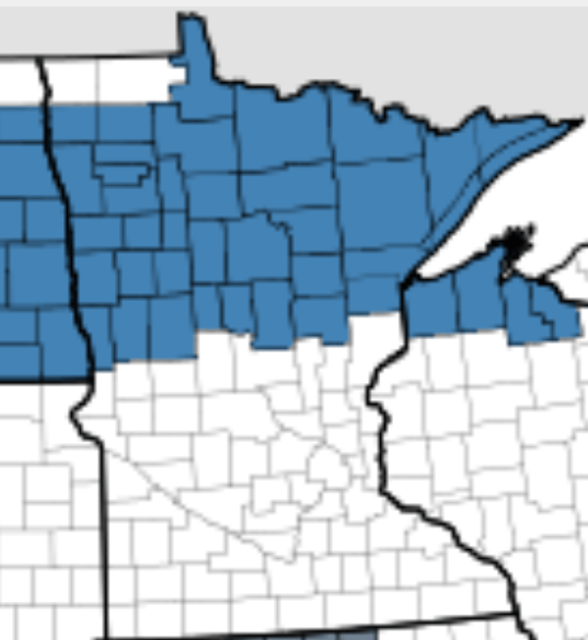 <figcaption class="figure_caption">
In the storm’s wake, winds will be blustery and temperatures chilly, producing wind chills in the single digits and even below zero from Thanksgiving Day into Friday.
<figure class="figure figure-none figure-full"><source type="image/gif" />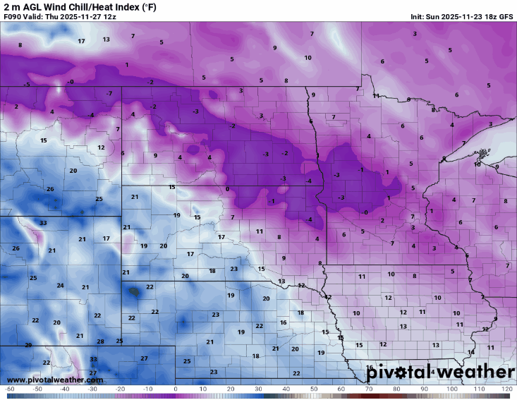 <figcaption class="figure_caption">


 United States
